MyTopo
Orleans Nebraska US Topo Map
Couldn't load pickup availability
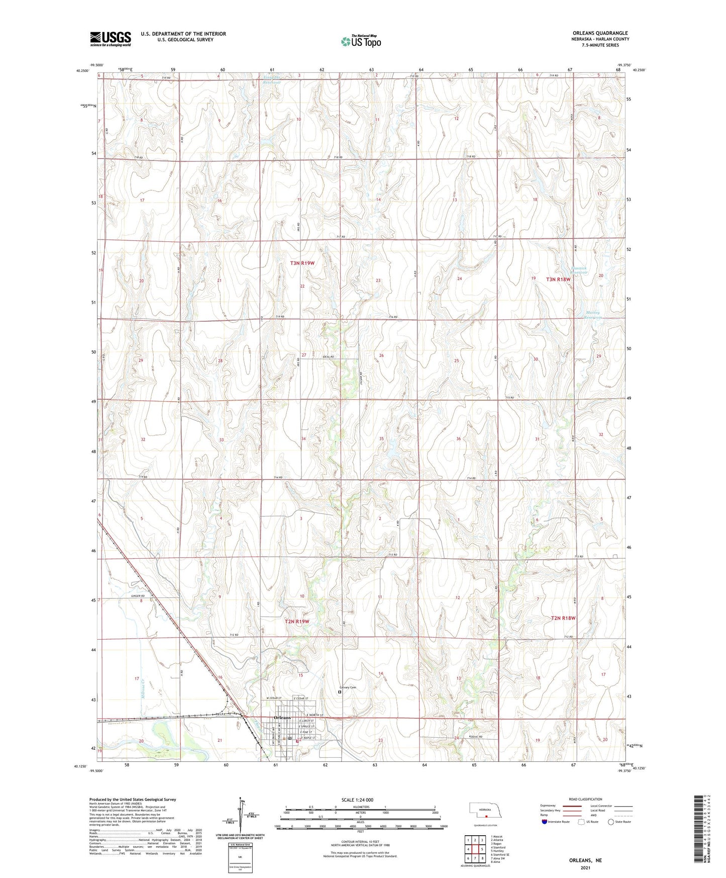
2021 topographic map quadrangle Orleans in the state of Nebraska. Scale: 1:24000. Based on the newly updated USGS 7.5' US Topo map series, this map is in the following counties: Harlan. The map contains contour data, water features, and other items you are used to seeing on USGS maps, but also has updated roads and other features. This is the next generation of topographic maps. Printed on high-quality waterproof paper with UV fade-resistant inks.
Quads adjacent to this one:
West: Stamford
Northwest: Mascot
North: Atlanta
Northeast: Ragan
East: Huntley
Southeast: Alma
South: Alma SW
Southwest: Stamford SE
Contains the following named places: Atlanta Elevator, Calvary Cemetery, Cordelia B Preston Memorial Library, Evangelical Free Church, Flasnick Dam, Flasnick Reservoir, Harlan County, L J Bose Airstrip, Massey Dam, Massey Reservoir, Milrose Creek, Orleans, Orleans Elevator, Orleans Post Office, Orleans Presbyterian Church, Orleans RV Park, Orleans Volunteer Fire Department, Richards Dam, Richards Reservoir, Saint Mary Catholic Church, Southern Valley Elementary at Orleans, Township of Orleans, Township of Reuben, Village of Orleans, ZIP Code: 68966