MyTopo
Alma Nebraska US Topo Map
Couldn't load pickup availability
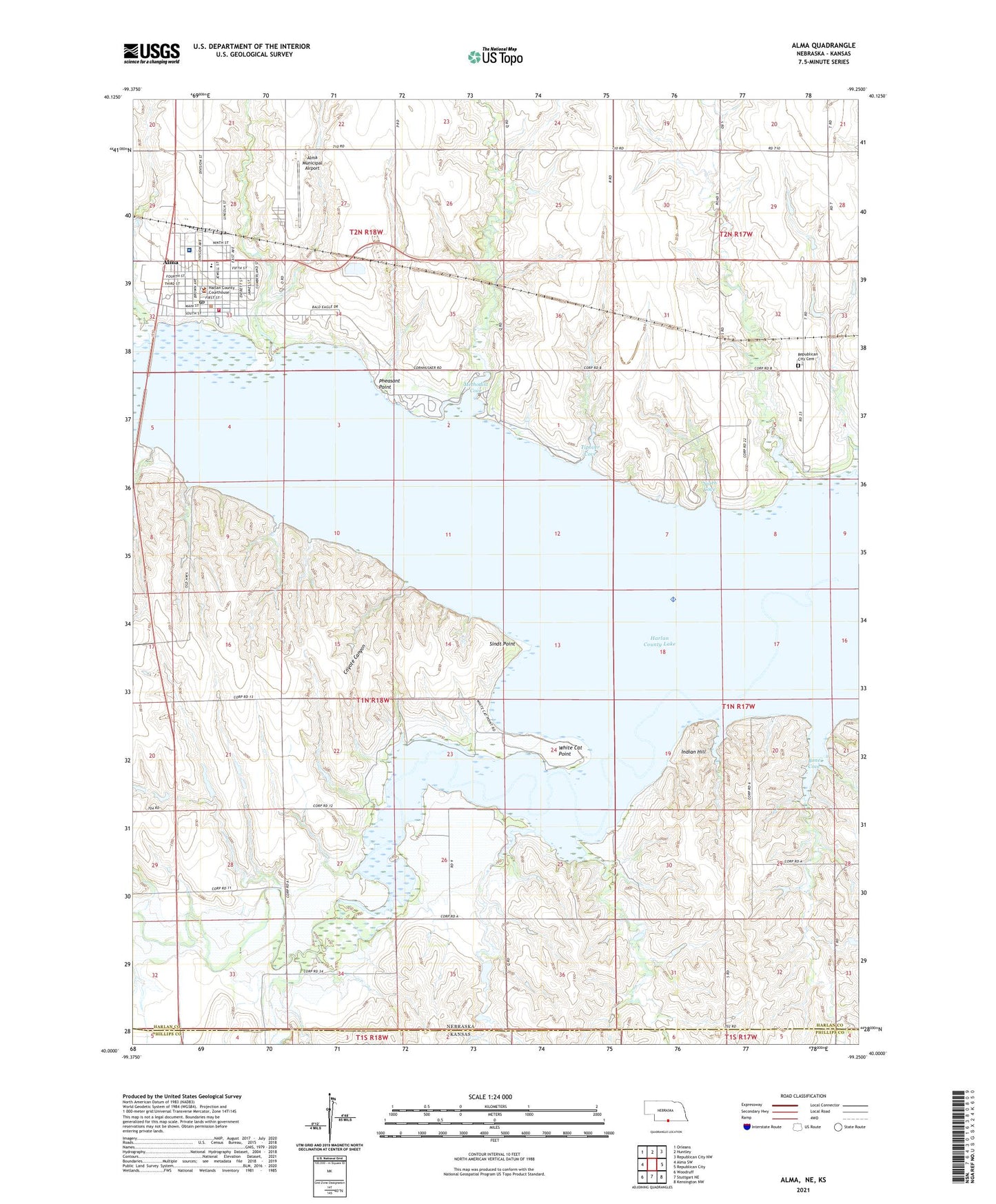
2021 topographic map quadrangle Alma in the state of Nebraska. Scale: 1:24000. Based on the newly updated USGS 7.5' US Topo map series, this map is in the following counties: Harlan, Phillips. The map contains contour data, water features, and other items you are used to seeing on USGS maps, but also has updated roads and other features. This is the next generation of topographic maps. Printed on high-quality waterproof paper with UV fade-resistant inks.
Quads adjacent to this one:
West: Alma SW
Northwest: Orleans
North: Huntley
Northeast: Republican City NW
East: Republican City
Southeast: Kensington NW
South: Stuttgart NE
Southwest: Woodruff
This map covers the same area as the classic USGS quad with code o40099a3.
Contains the following named places: Agri Co-op Elevator, Alma, Alma City Park, Alma Dental Clinic, Alma Evangelical Free Church, Alma Municipal Airport, Alma Municipal Golf Course, Alma Post Office, Alma Public Schools, Alma Vista Picnic Area, Alma Volunteer Fire Department, Boat Ramp, Bone Cove, Bone Creek, City of Alma, City of Alma Trailer Park, Colonial Villa Good Samaritan Center, Cook Creek, Coyote Canyon, Crystal Creek, First Christian Church, Free Methodist Church, Harlan County Court House, Harlan County Health System Hospital, Harlan County Lake, Harlan County Lake Recreation Area, Harlan County Lake Seaplane Base, Harlan County Medical Clinic, Harlan County Sheriff's Office, Hoesch Memorial Library, Indian Hill, Methodist Cove, Methodist Cove Campground, Methodist Creek, Mill Creek, North Cove, North Cove Campground, Peace Lutheran Church, Pheasant Point, Prairie Dog Bay, Prairie Dog Creek, Republican City Cemetery, Saint Joseph Catholic Church, Sindt Point, Tipover Cove, Tipover Creek, Township of Prairie Dog, United Methodist Church, Walnut Creek, White Cat Point