MyTopo
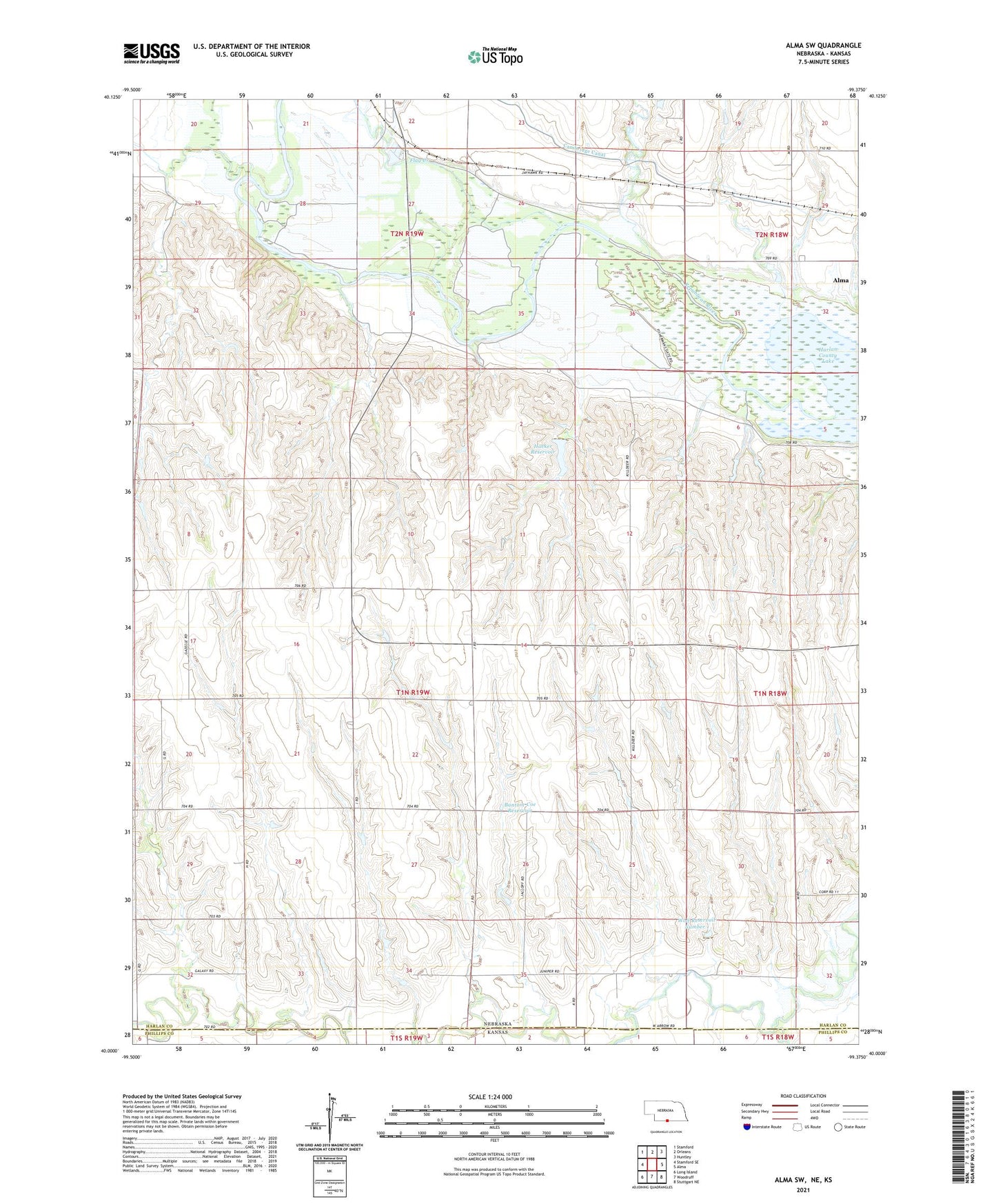
Alma SW Nebraska US Topo Map
Couldn't load pickup availability
2021 topographic map quadrangle Alma SW in the states of Nebraska, Kansas. Scale: 1:24000. Based on the newly updated USGS 7.5' US Topo map series, this map is in the following counties: Harlan, Phillips. The map contains contour data, water features, and other items you are used to seeing on USGS maps, but also has updated roads and other features. This is the next generation of topographic maps. Printed on high-quality waterproof paper with UV fade-resistant inks.
Quads adjacent to this one:
West: Stamford SE
Northwest: Stamford
North: Orleans
Northeast: Huntley
East: Alma
Southeast: Stuttgart NE
South: Woodruff
Southwest: Long Island
This map covers the same area as the classic USGS quad with code o40099a4.
Contains the following named places: Bantom-Coe Dam, Bantom-Coe Reservoir, Dry Creek, Flag Creek, Haeker Dam, Haeker Reservoir, Rope Canal, Rope Creek, Sappa Creek, Spring Brook, Township of Eldorado, Wolf Dam Number 1, Wolf Reservoir Number 1