MyTopo
Phillips Nebraska US Topo Map
Couldn't load pickup availability
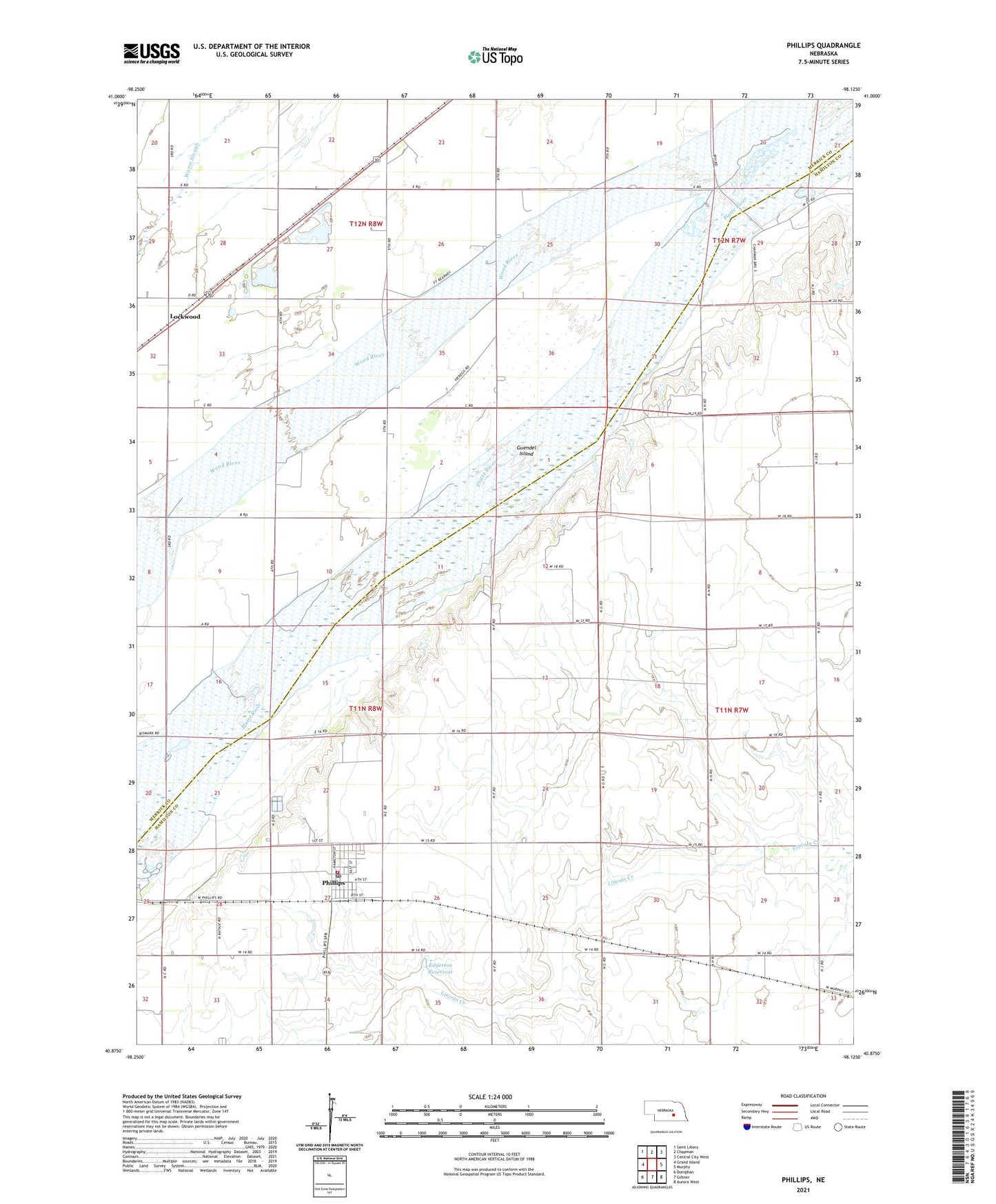
2021 topographic map quadrangle Phillips in the state of Nebraska. Scale: 1:24000. Based on the newly updated USGS 7.5' US Topo map series, this map is in the following counties: Hamilton, Merrick. The map contains contour data, water features, and other items you are used to seeing on USGS maps, but also has updated roads and other features. This is the next generation of topographic maps. Printed on high-quality waterproof paper with UV fade-resistant inks.
Quads adjacent to this one:
West: Grand Island
Northwest: Saint Libory
North: Chapman
Northeast: Central City West
East: Murphy
Southeast: Aurora West
South: Giltner
Southwest: Doniphan
Contains the following named places: Bader Memorial Park, Edgerton Dam, Edgerton Reservoir, Election Precinct 5, Guendel Island, Izaak Walton League Park, Lockwood, Lockwood Post Office, Phillips, Phillips City School, Phillips Post Office, Phillips Volunteer Fire Department, School Number 17, School Number 2, Terry Farm Airport, Township of Phillips, Township of Vieregg, United Methodist Church, Village of Phillips, Warm Slough, ZIP Code: 68865