MyTopo
Giltner Nebraska US Topo Map
Couldn't load pickup availability
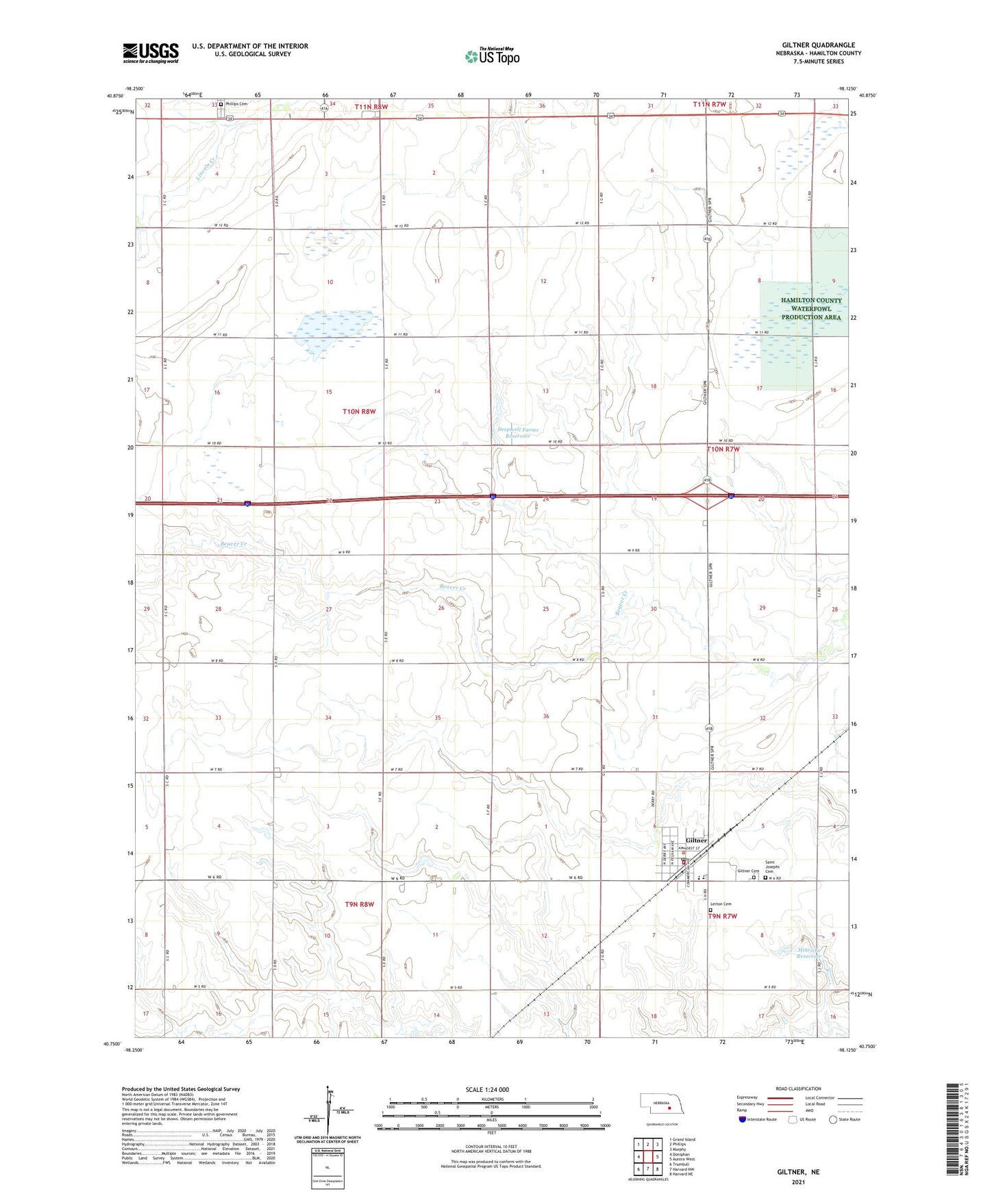
2021 topographic map quadrangle Giltner in the state of Nebraska. Scale: 1:24000. Based on the newly updated USGS 7.5' US Topo map series, this map is in the following counties: Hamilton. The map contains contour data, water features, and other items you are used to seeing on USGS maps, but also has updated roads and other features. This is the next generation of topographic maps. Printed on high-quality waterproof paper with UV fade-resistant inks.
Quads adjacent to this one:
West: Doniphan
Northwest: Grand Island
North: Phillips
Northeast: Murphy
East: Aurora West
Southeast: Harvard NE
South: Harvard NW
Southwest: Trumbull
This map covers the same area as the classic USGS quad with code o40098g2.
Contains the following named places: Deep Well State Wildlife Management Area, Deepwell Farms Reservoir, Election Precinct 2, Giltner, Giltner Cemetery, Giltner Post Office, Giltner Public Library, Giltner Public Schools, Giltner Rural Fire Department, Hamilton County Waterfowl Production Area, Heartland Cooperative Elevator, Hinrichs Dam, Hinrichs Reservoir, Lerton Cemetery, Otto Dam, Phillips Cemetery, Saint Joseph Catholic Church, Saint Josephs Cemetery, Springer Federal Waterfowl Production Area, Township of Deep Well, United Methodist Church, Village of Giltner, ZIP Code: 68841