MyTopo
Doniphan Nebraska US Topo Map
Couldn't load pickup availability
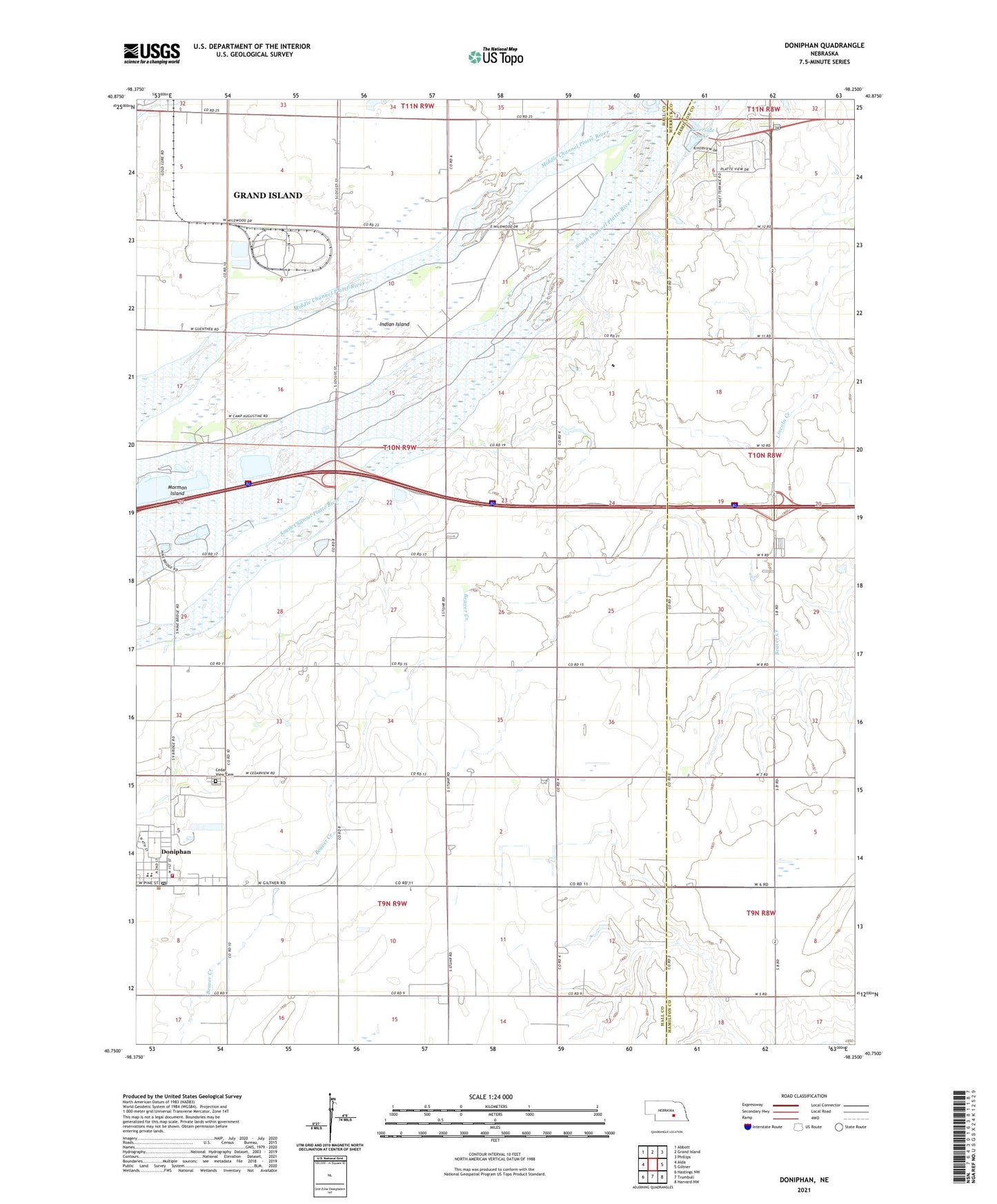
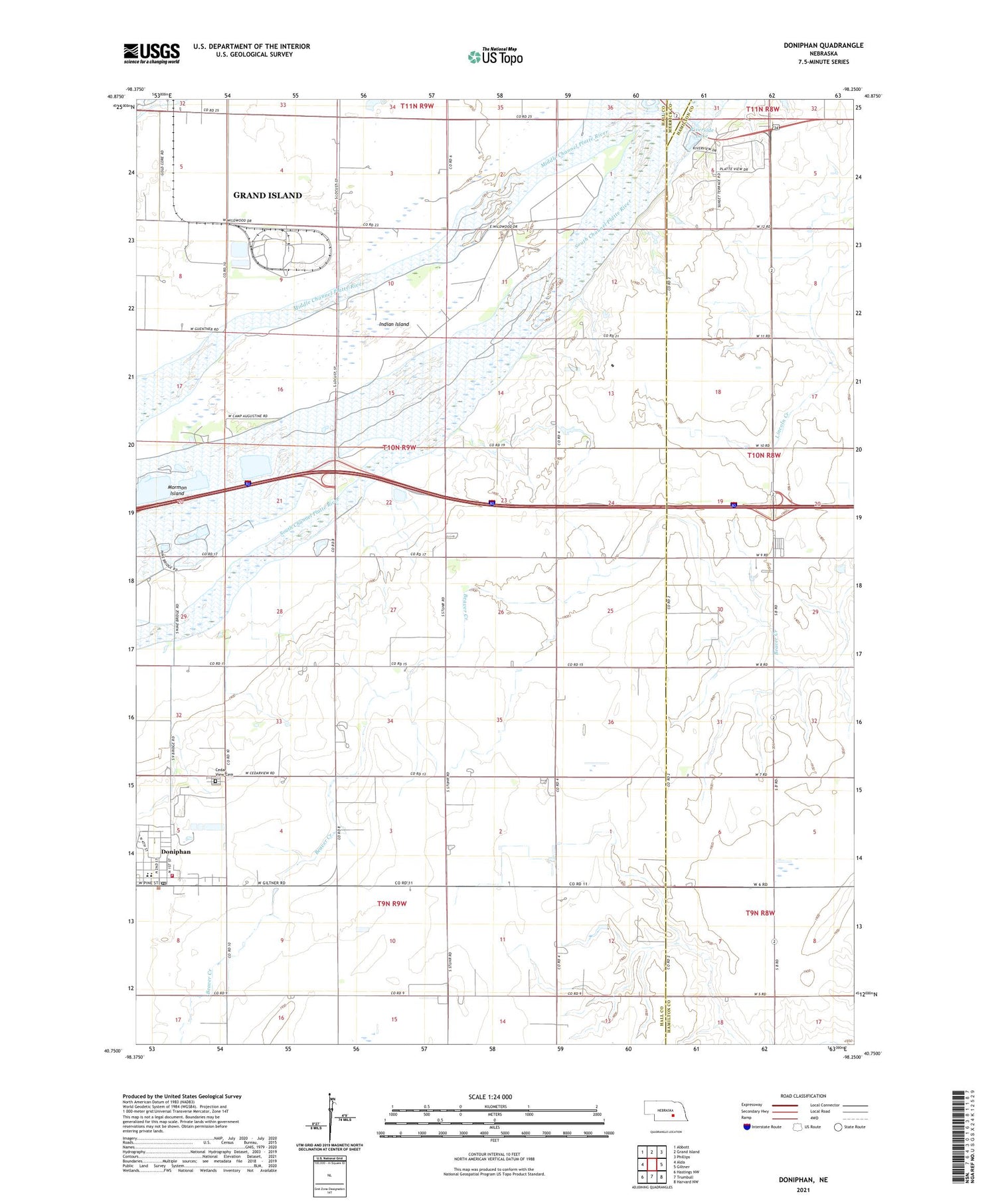
2021 topographic map quadrangle Doniphan in the state of Nebraska. Scale: 1:24000. Based on the newly updated USGS 7.5' US Topo map series, this map is in the following counties: Hall, Hamilton, Merrick. The map contains contour data, water features, and other items you are used to seeing on USGS maps, but also has updated roads and other features. This is the next generation of topographic maps. Printed on high-quality waterproof paper with UV fade-resistant inks.
Quads adjacent to this one:
West: Alda
Northwest: Abbott
North: Grand Island
Northeast: Phillips
East: Giltner
Southeast: Harvard NW
South: Trumbull
Southwest: Hastings NW
This map covers the same area as the classic USGS quad with code o40098g3.
Contains the following named places: Camp Augustine, Camp Cosmopolitan, Cedar View Cemetery, Do-Mar Mobile Home Park, Doniphan, Doniphan Post Office, Doniphan Public Schools, Doniphan Volunteer Fire and Rescue, Ermas Desire Sculpture, Grand Island Historical Marker, Grand Island Rest Area - Eastbound, Grand Island Rest Area - Westbound, Grand Island RV Park, Indian Island, Junctionville, Junctionville Marker, Junctionville Post Office, KRGI-AM (Grand Island), KROA-FM (Grand Island), Middle Channel Platte River, Morman Island State Wildlife Management Area, Mormon Island, Riverside Lake, Saint Anns Catholic Church, Saint Joseph and Grand Island Railroad Historical Marker, Saint Paul Lutheran Church, School Number 19, School Number 40, School Number 53, South Channel Platte River, Township of Doniphan, United Methodist Church, Village of Doniphan, ZIP Code: 68832