MyTopo
Pishelville Nebraska US Topo Map
Couldn't load pickup availability
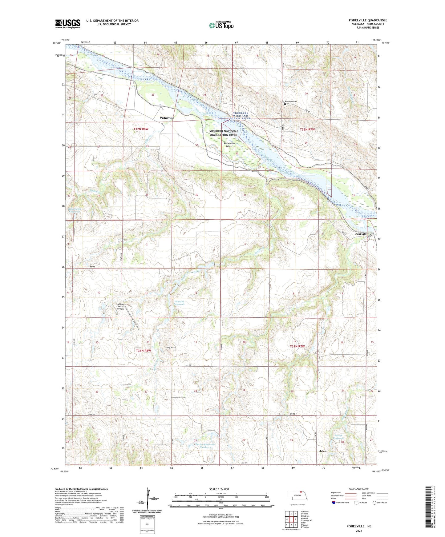
2021 topographic map quadrangle Pishelville in the state of Nebraska. Scale: 1:24000. Based on the newly updated USGS 7.5' US Topo map series, this map is in the following counties: Knox. The map contains contour data, water features, and other items you are used to seeing on USGS maps, but also has updated roads and other features. This is the next generation of topographic maps. Printed on high-quality waterproof paper with UV fade-resistant inks.
Quads adjacent to this one:
West: Dorsey
Northwest: Monowi
North: Verdel
East: Verdigre NE
Southeast: Verdigre
South: Walnut
Southwest: Star
Contains the following named places: Bartos Dam Number 2, Bartos Reservoir Number 2, Berg School, Bohemia Prairie State Wildlife Management Area, Cottonwood Row School, Dukeville, Dukeville Post Office, Farnik Dam, Farnik Reservoir, Haineraich Dam, Haineraich Reservoir, Jelen, Jelen Post Office, Lightner Ranch Airport, Meadowville School, Pishel Creek, Pishelville, Pishelville Island, Pishelville Post Office, Riverview Cemetery, Soldier Creek, Stony Butte, Stony Butte School, Township of Bohemia, Township of Washington, Township of Western, Vonasek Dam, Vonasek Reservoir