MyTopo
Walnut Nebraska US Topo Map
Couldn't load pickup availability
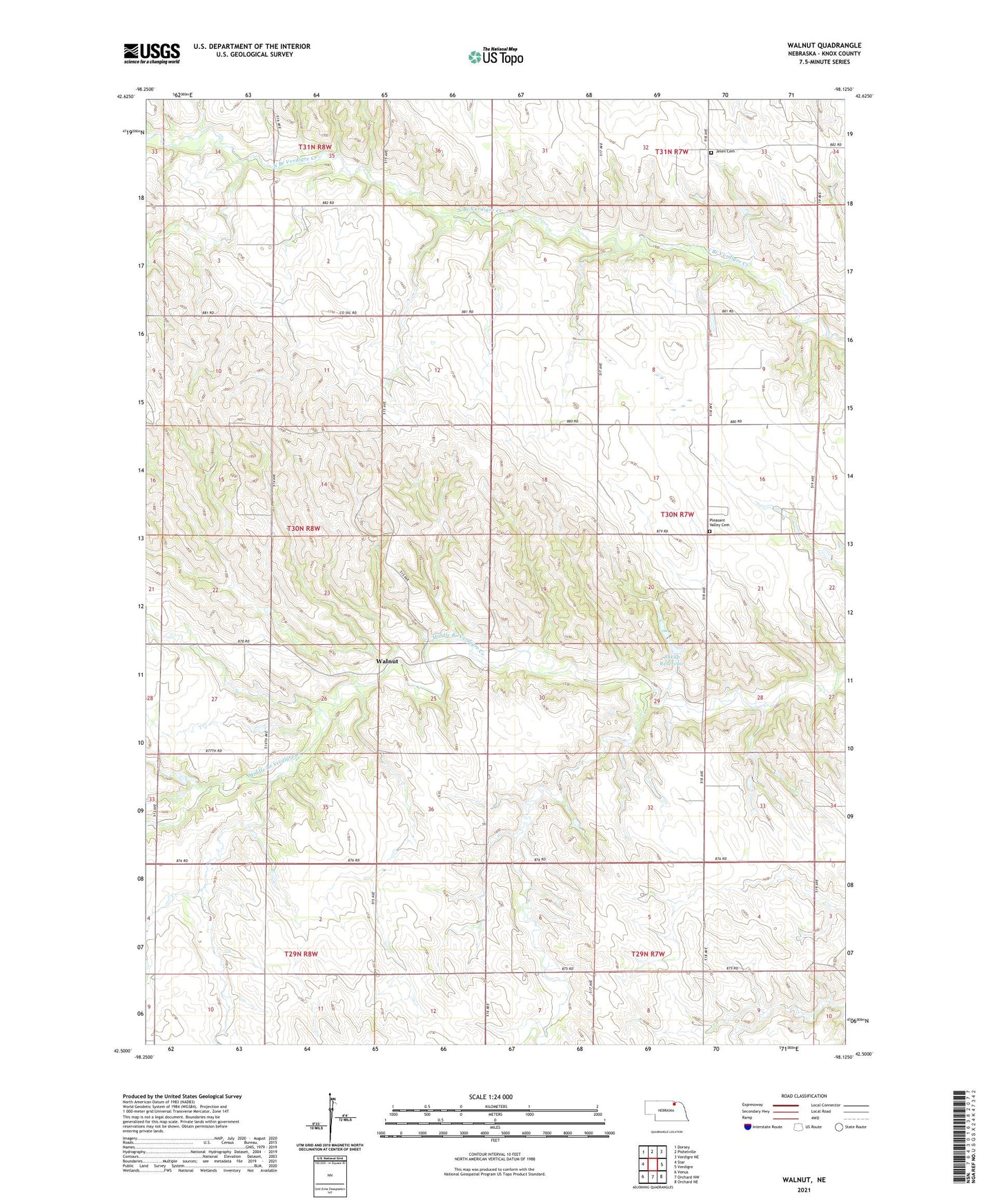
2021 topographic map quadrangle Walnut in the state of Nebraska. Scale: 1:24000. Based on the newly updated USGS 7.5' US Topo map series, this map is in the following counties: Knox. The map contains contour data, water features, and other items you are used to seeing on USGS maps, but also has updated roads and other features. This is the next generation of topographic maps. Printed on high-quality waterproof paper with UV fade-resistant inks.
Quads adjacent to this one:
West: Star
Northwest: Dorsey
North: Pishelville
Northeast: Verdigre NE
East: Verdigre
Southeast: Orchard NE
South: Orchard NW
Southwest: Venus
This map covers the same area as the classic USGS quad with code o42098e2.
Contains the following named places: Cottonwood Grove School, Greenvale State Wildlife Management Area, Jelen Cemetery, Oak Valley School, Pleasant Valley Cemetery, Saint Paul Church, School Number 18, School Number 47, School Number 61, School Number 62, Sukup Dam, Sukup Dam-1 Dam, Sukup Reservoir, Township of Jefferson, Township of Walnut Grove, Walnut, Walnut Post Office, ZIP Code: 68783