MyTopo
Pleasanton Nebraska US Topo Map
Couldn't load pickup availability
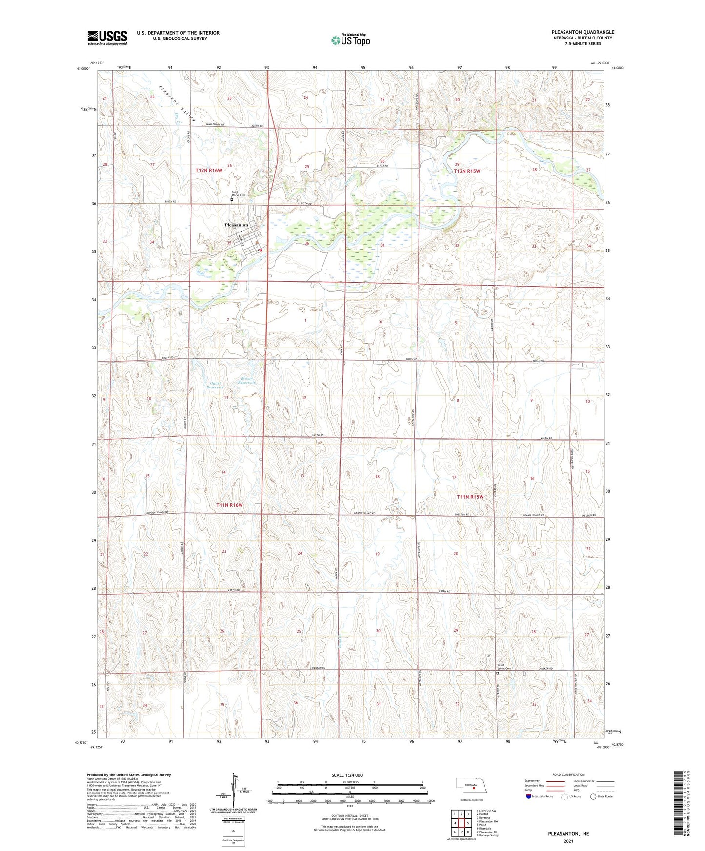
2021 topographic map quadrangle Pleasanton in the state of Nebraska. Scale: 1:24000. Based on the newly updated USGS 7.5' US Topo map series, this map is in the following counties: Buffalo. The map contains contour data, water features, and other items you are used to seeing on USGS maps, but also has updated roads and other features. This is the next generation of topographic maps. Printed on high-quality waterproof paper with UV fade-resistant inks.
Quads adjacent to this one:
West: Pleasanton NW
Northwest: Litchfield SW
North: Hazard
Northeast: Ravenna
East: Poole
Southeast: Buckeye Valley
South: Pleasanton SE
Southwest: Riverdale
Contains the following named places: Brown Dam, Brown Reservoir, Dry Creek, Election Precinct 16, Evangelical Free Church, Grace Church, Gunst Dam, Gunst Reservoir, Pleasant Valley, Pleasanton, Pleasanton Post Office, Pleasanton Public Schools, Pleasanton Rural Fire Department, Prairie Hills Golf and Ski Club, Rusco Creek, Saint Johns Cemetery, Saint Marys Catholic Church, Saint Marys Cemetery, Township of Cedar, United Methodist Church, Village of Pleasanton, ZIP Code: 68866