MyTopo
Riverdale Nebraska US Topo Map
Couldn't load pickup availability
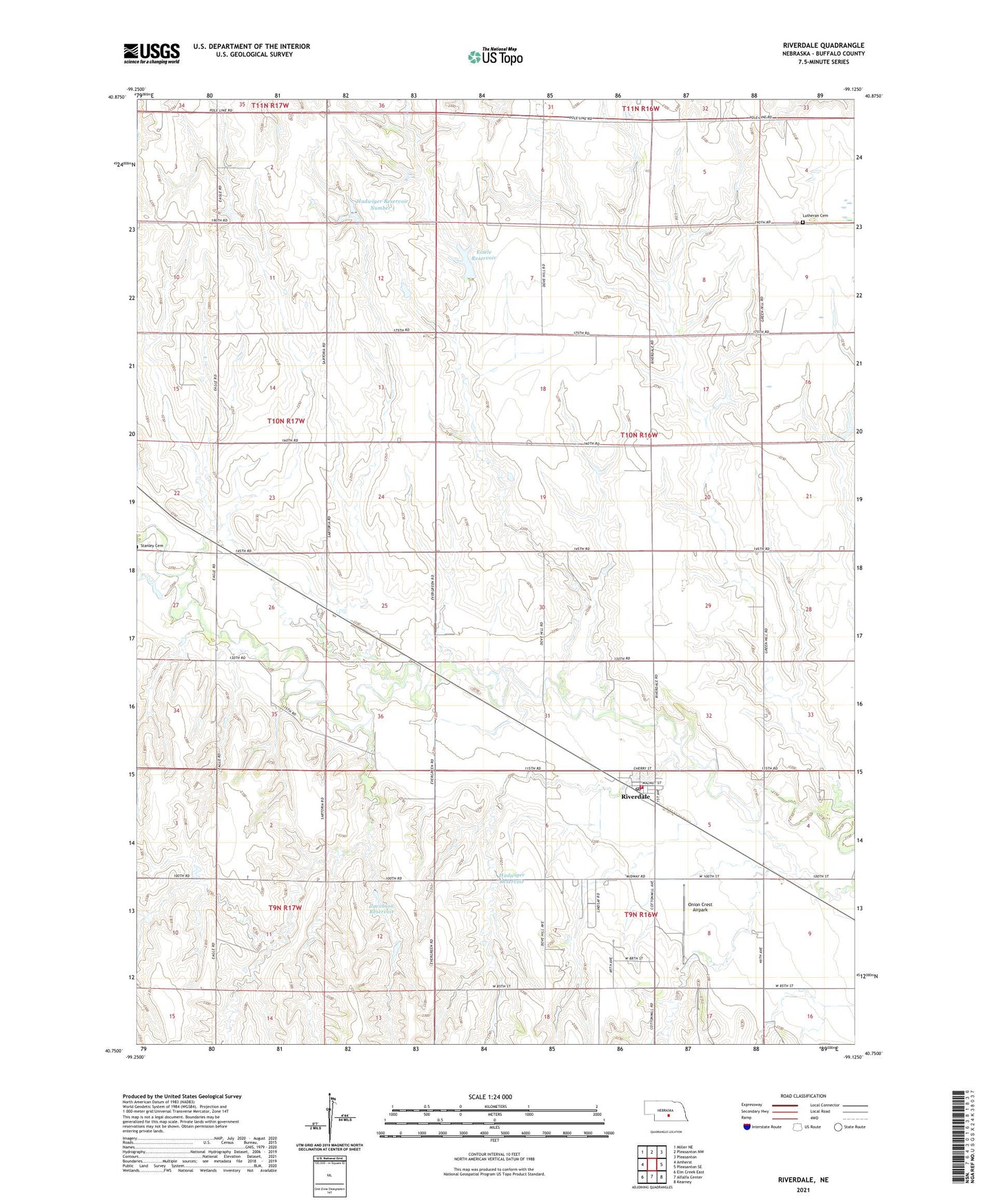
2021 topographic map quadrangle Riverdale in the state of Nebraska. Scale: 1:24000. Based on the newly updated USGS 7.5' US Topo map series, this map is in the following counties: Buffalo. The map contains contour data, water features, and other items you are used to seeing on USGS maps, but also has updated roads and other features. This is the next generation of topographic maps. Printed on high-quality waterproof paper with UV fade-resistant inks.
Quads adjacent to this one:
West: Amherst
Northwest: Miller NE
North: Pleasanton NW
Northeast: Pleasanton
East: Pleasanton SE
Southeast: Kearney
South: Alfalfa Center
Southwest: Elm Creek East
This map covers the same area as the classic USGS quad with code o40099g2.
Contains the following named places: Eisele Dam, Eisele Reservoir, Election Precinct 28, Hadwiger Dam, Hadwiger Dam Number 1, Hadwiger Reservoir, Hadwiger Reservoir Number 1, Jacobson Dam, Jacobson Reservoir, Kearney Volunteer Fire Department - Riverdale Station, Lutheran Cemetery, Onion Crest Airpark, Riverdale, Riverdale Post Office, Riverdale Public School, School Number 55, Township of Divide, Township of Riverdale, Village of Riverdale, ZIP Code: 68870