MyTopo
Pole Creek Valley Nebraska US Topo Map
Couldn't load pickup availability
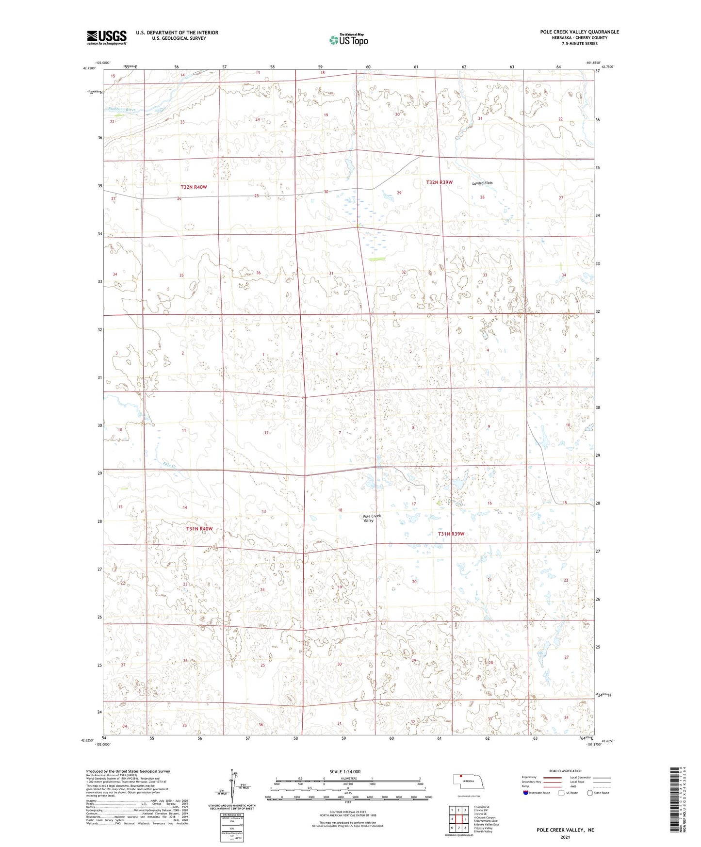
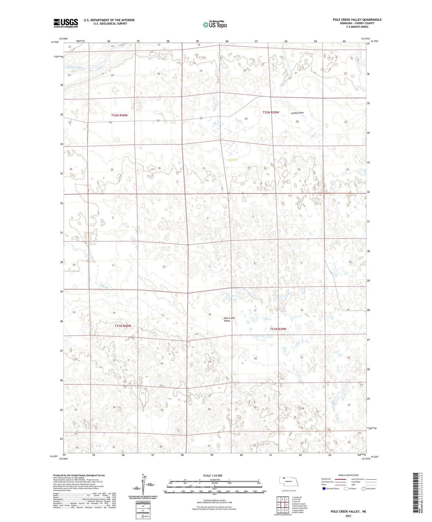
2021 topographic map quadrangle Pole Creek Valley in the state of Nebraska. Scale: 1:24000. Based on the newly updated USGS 7.5' US Topo map series, this map is in the following counties: Cherry. The map contains contour data, water features, and other items you are used to seeing on USGS maps, but also has updated roads and other features. This is the next generation of topographic maps. Printed on high-quality waterproof paper with UV fade-resistant inks.
Quads adjacent to this one:
West: Coburn Canyon
Northwest: Gordon SE
North: Irwin SW
Northeast: Irwin SE
East: Bornemann Lake
Southeast: North Valley
South: Gypsy Valley
Southwest: Bovee Valley East
This map covers the same area as the classic USGS quad with code o42101f8.
Contains the following named places: A Bar Ranch, Albert Timm Ranch, Downing Ranch, Fair Ranch, Frank Timm Ranch, George Jansen Ranch, Hooper Ranch, Jerry Jansen Ranch, Knight Ranch, Lavaca Flats, Mishler Ranch, Pioneer Public School, Pole Creek Valley, School Number 129, School Number 19, School Number 26, Shald Ranch, Thomas Ranch, Walter Timm Ranch