MyTopo
Poole Nebraska US Topo Map
Couldn't load pickup availability
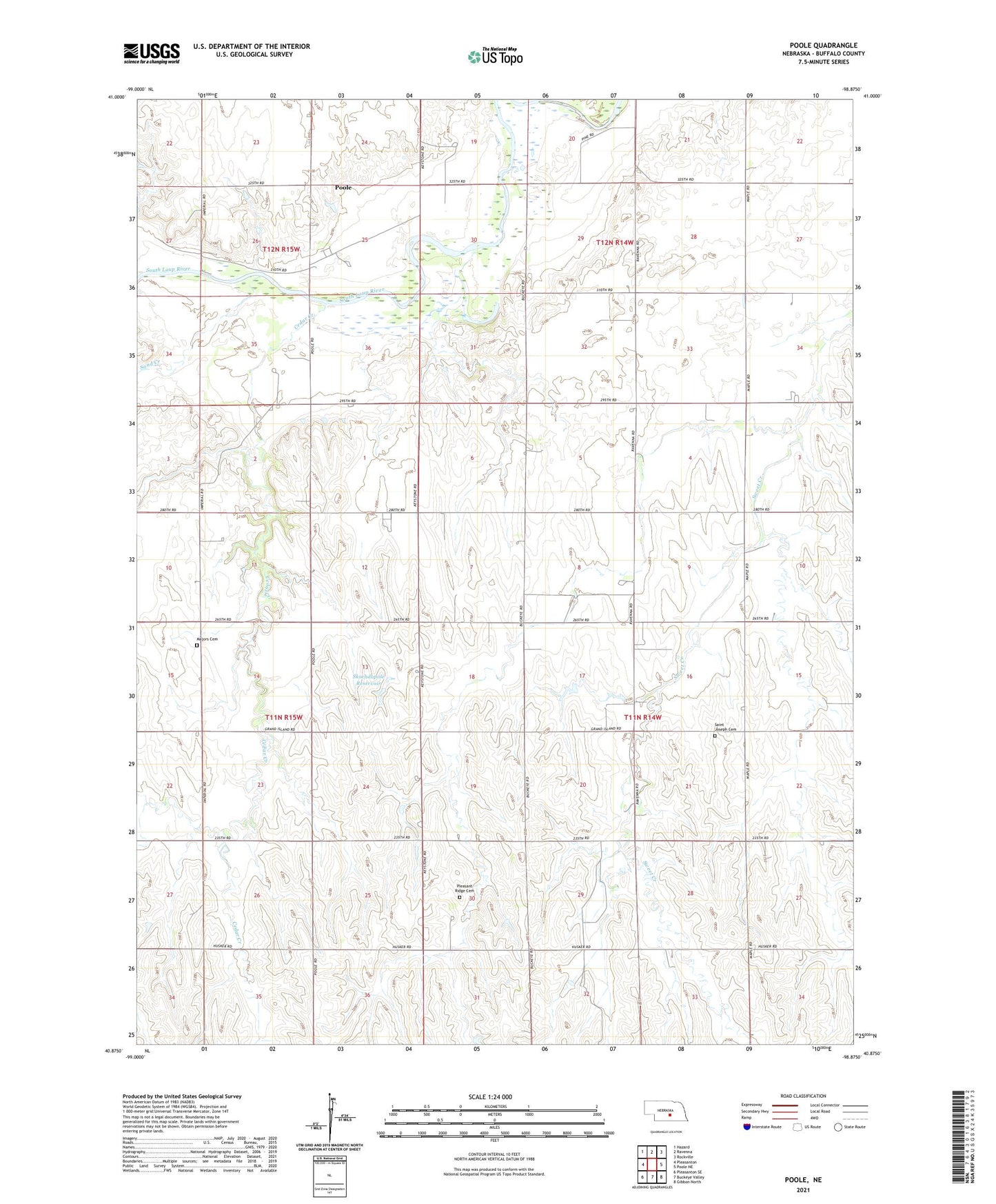
2021 topographic map quadrangle Poole in the state of Nebraska. Scale: 1:24000. Based on the newly updated USGS 7.5' US Topo map series, this map is in the following counties: Buffalo. The map contains contour data, water features, and other items you are used to seeing on USGS maps, but also has updated roads and other features. This is the next generation of topographic maps. Printed on high-quality waterproof paper with UV fade-resistant inks.
Quads adjacent to this one:
West: Pleasanton
Northwest: Hazard
North: Ravenna
Northeast: Rockville
East: Poole NE
Southeast: Gibbon North
South: Buckeye Valley
Southwest: Pleasanton SE
Contains the following named places: Cedar Creek, Majors Cemetery, Pleasant Ridge Cemetery, Poole, Poole Census Designated Place, Poole Post Office, Poole School, Saint Joseph Cemetery, Sand Creek, School Number 107, School Number 39, School Number 70, School Number 92, Skochdopole Dam, Skochdopole Reservoir, Township of Schneider, ZIP Code: 68869