MyTopo
Purdum Nebraska US Topo Map
Couldn't load pickup availability
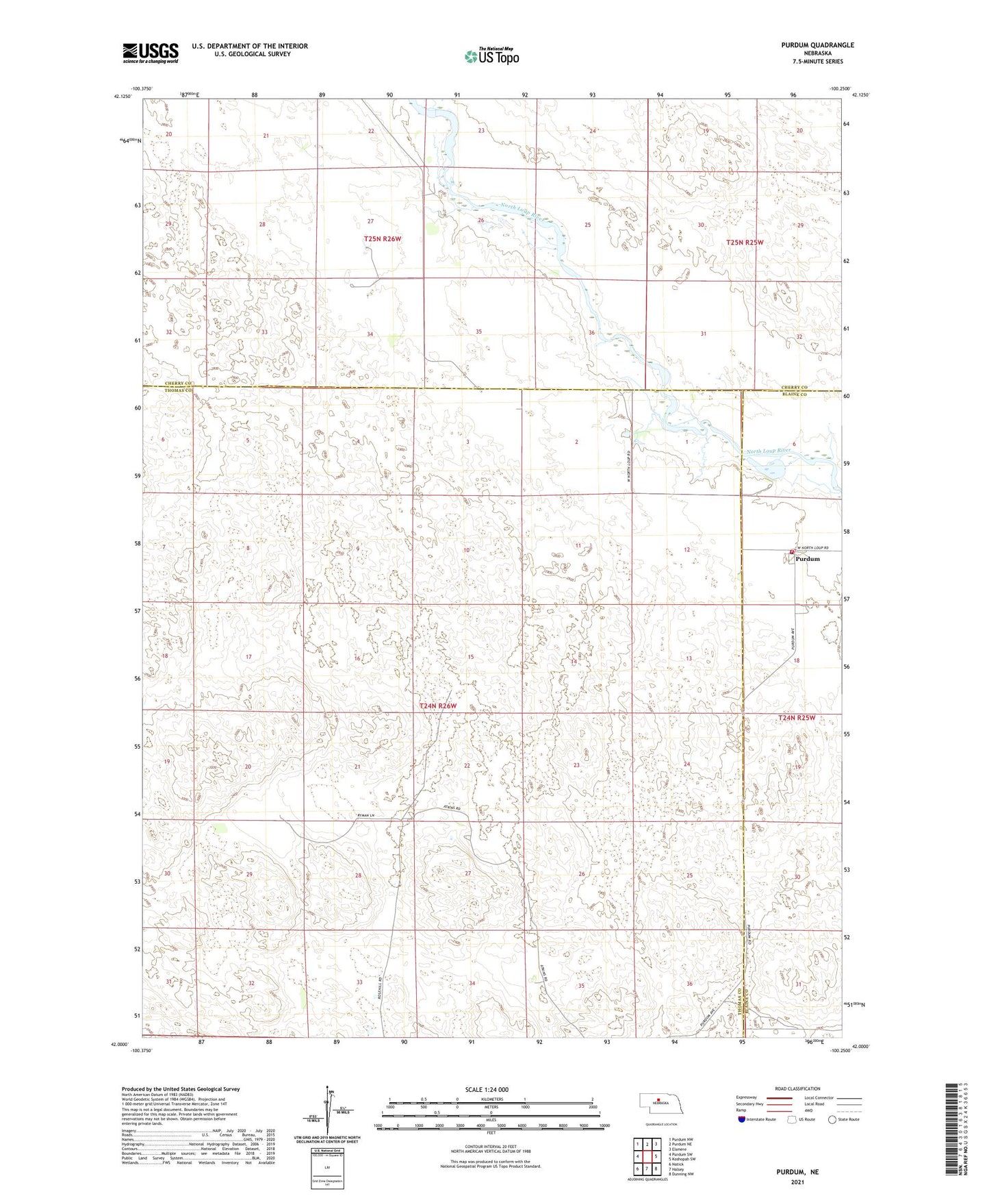
2021 topographic map quadrangle Purdum in the state of Nebraska. Scale: 1:24000. Based on the newly updated USGS 7.5' US Topo map series, this map is in the following counties: Thomas, Cherry, Blaine. The map contains contour data, water features, and other items you are used to seeing on USGS maps, but also has updated roads and other features. This is the next generation of topographic maps. Printed on high-quality waterproof paper with UV fade-resistant inks.
Quads adjacent to this one:
West: Purdum SW
Northwest: Purdum NW
North: Purdum NE
Northeast: Elsmere
East: Koshopah SW
Southeast: Dunning NW
South: Halsey
Southwest: Natick
This map covers the same area as the classic USGS quad with code o42100a3.
Contains the following named places: Bussard Ranch, Cowdin Ranch, Fisher Ranch, Johnson Ranch, Martin Ranch, Moody Ranch, Naber Ranch, Purdum, Purdum Post Office, Purdum Rural Fire District, Purdum United Church of Christ, Rodocker Ranch, Ryman Brothers Ranch, West Purdum School