MyTopo
Rockville Nebraska US Topo Map
Couldn't load pickup availability
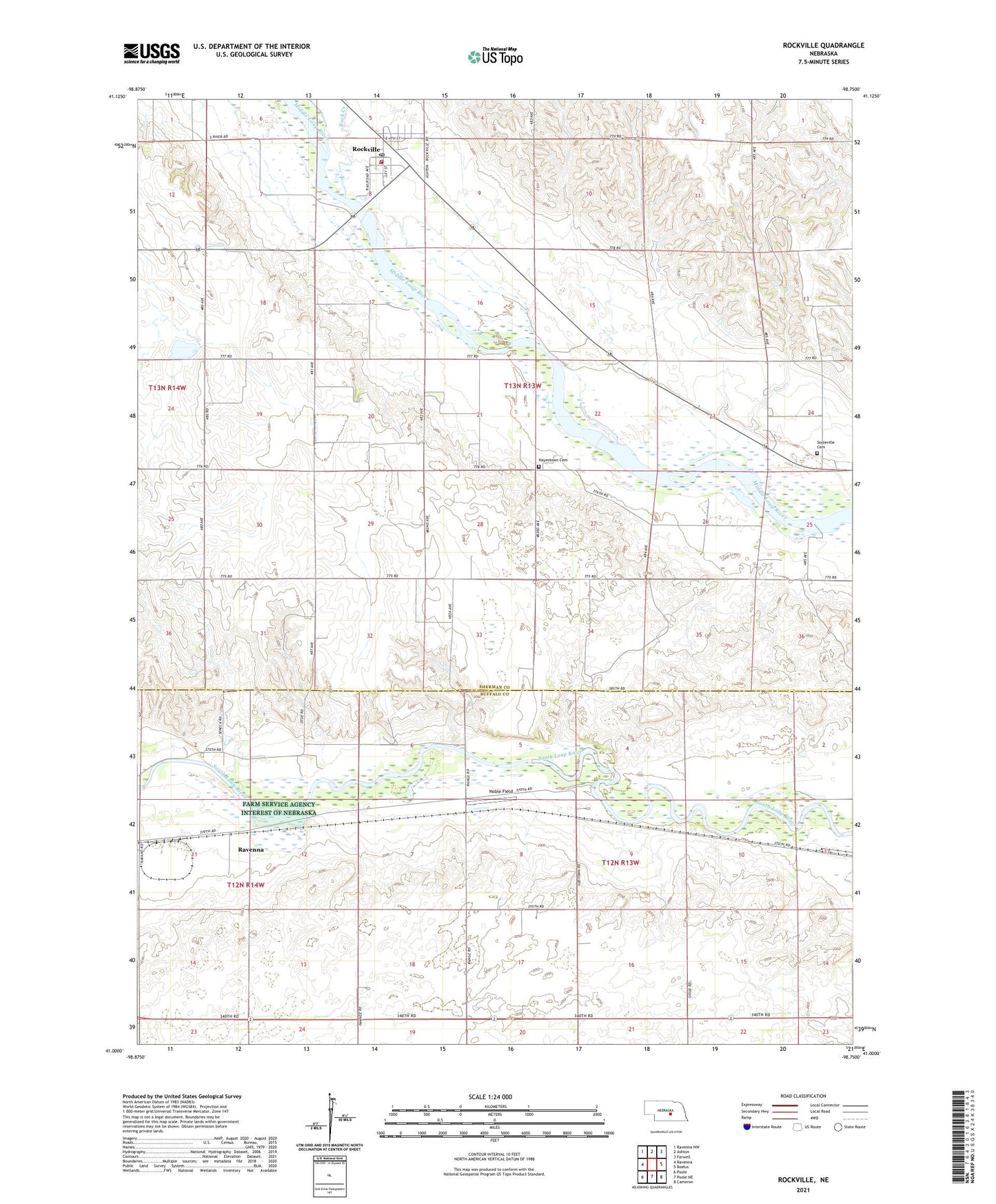
2021 topographic map quadrangle Rockville in the state of Nebraska. Scale: 1:24000. Based on the newly updated USGS 7.5' US Topo map series, this map is in the following counties: Sherman, Buffalo. The map contains contour data, water features, and other items you are used to seeing on USGS maps, but also has updated roads and other features. This is the next generation of topographic maps. Printed on high-quality waterproof paper with UV fade-resistant inks.
Quads adjacent to this one:
West: Ravenna
Northwest: Ravenna NW
North: Ashton
Northeast: Farwell
East: Boelus
Southeast: Cameron
South: Poole NE
Southwest: Poole
Contains the following named places: Coulter School, Hayestown Cemetery, Nantasket, Nantasket Post Office, Nantasket School, Noble Field, Pleasant View School, Rock Creek, Rockville, Rockville Post Office, Rockville Volunteer Fire Department, Saint Marys Catholic Church, School Number 18, School Number 19, School Number 3, Souleville Cemetery, Township of Cherry Creek, Village of Rockville