MyTopo
Scotia Nebraska US Topo Map
Couldn't load pickup availability
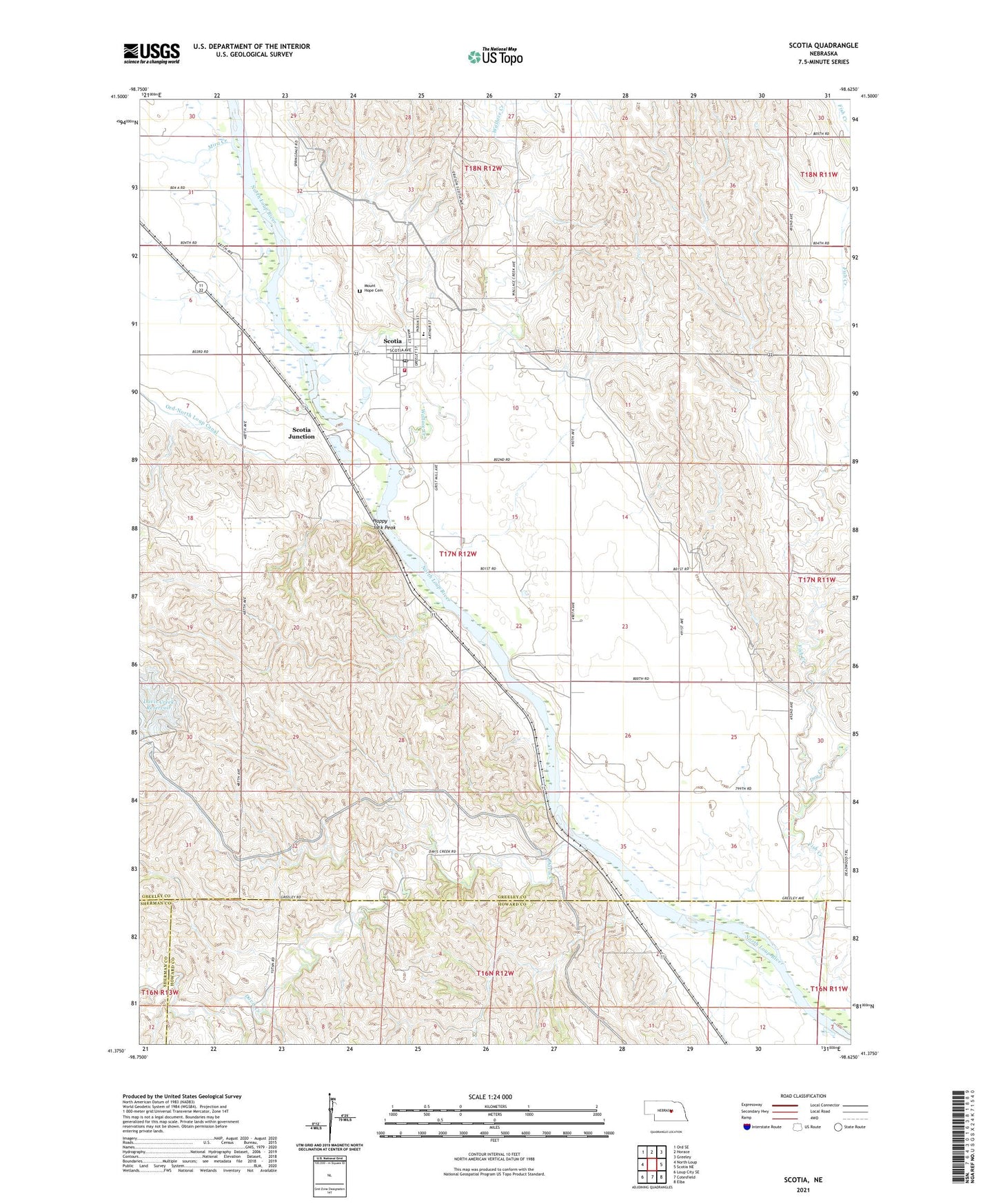
2021 topographic map quadrangle Scotia in the state of Nebraska. Scale: 1:24000. Based on the newly updated USGS 7.5' US Topo map series, this map is in the following counties: Greeley, Howard, Sherman. The map contains contour data, water features, and other items you are used to seeing on USGS maps, but also has updated roads and other features. This is the next generation of topographic maps. Printed on high-quality waterproof paper with UV fade-resistant inks.
Quads adjacent to this one:
West: North Loup
Northwest: Ord SE
North: Horace
Northeast: Greeley
East: Scotia NE
Southeast: Elba
South: Cotesfield
Southwest: Loup City SE
Contains the following named places: Boxelder Creek, Cedar Hills Church, Chalk Mine Historical Marker, Davis Creek, Davis Creek Dam, Dry Creek, Happy Jack Chalk Mine, Happy Jack Peak, Mira Creek, Mount Hope Cemetery, North Loup Scotia Public Schools, Platte Valley Academy, Saint Patricks Catholic Church, Scotia, Scotia Airport, Scotia Baptist Church, Scotia Election Precinct, Scotia Junction, Scotia Normal and Business University, Scotia Post Office, Scotia Public Library, Scotia Rural Fire and Rescue, Scotia United Methodist Church, Springdale Christian School, Township of Scotia, Village of Scotia, Wallace Creek, Zion Lutheran Church