MyTopo
North Loup Nebraska US Topo Map
Couldn't load pickup availability
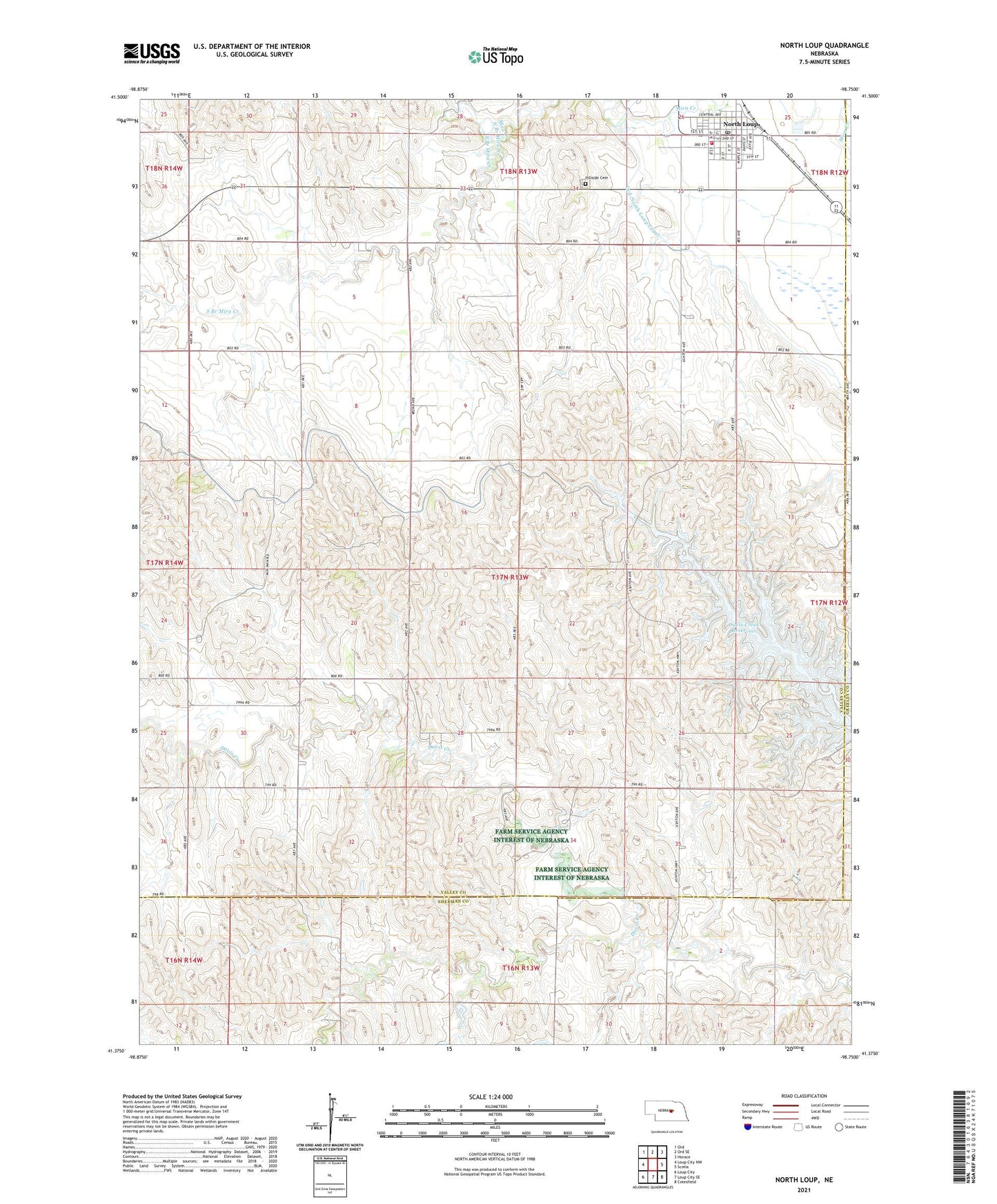
2021 topographic map quadrangle North Loup in the state of Nebraska. Scale: 1:24000. Based on the newly updated USGS 7.5' US Topo map series, this map is in the following counties: Valley, Sherman, Greeley. The map contains contour data, water features, and other items you are used to seeing on USGS maps, but also has updated roads and other features. This is the next generation of topographic maps. Printed on high-quality waterproof paper with UV fade-resistant inks.
Quads adjacent to this one:
West: Loup City NW
Northwest: Ord
North: Ord SE
Northeast: Horace
East: Scotia
Southeast: Cotesfield
South: Loup City SE
Southwest: Loup City
This map covers the same area as the classic USGS quad with code o41098d7.
Contains the following named places: Davis Creek Dam Campground, Davis Creek Reservoir, Davis Creek State Wildlife Management Area, Deer Creek School, Hickman Dam Number 1, Hickman Reservoir Number 1, Hillside Cemetery, North Branch Mira Creek, North Loup, North Loup Elementary School, North Loup Medical Center, North Loup Post Office, North Loup Rural Fire Protection District, North Loup Township Library, North Loup Trailer Park, Pleasant Hill School, School Number 24, School Number 3, School Number 46, School Number 66, Seventh Day Baptist Church, South Branch Mira Creek, Spalding Cooperative Elevator, Township of Independent, Union Ridge School, United Methodist Church, Village of North Loup, ZIP Code: 68859