MyTopo
Skunk Lake NW Nebraska US Topo Map
Couldn't load pickup availability
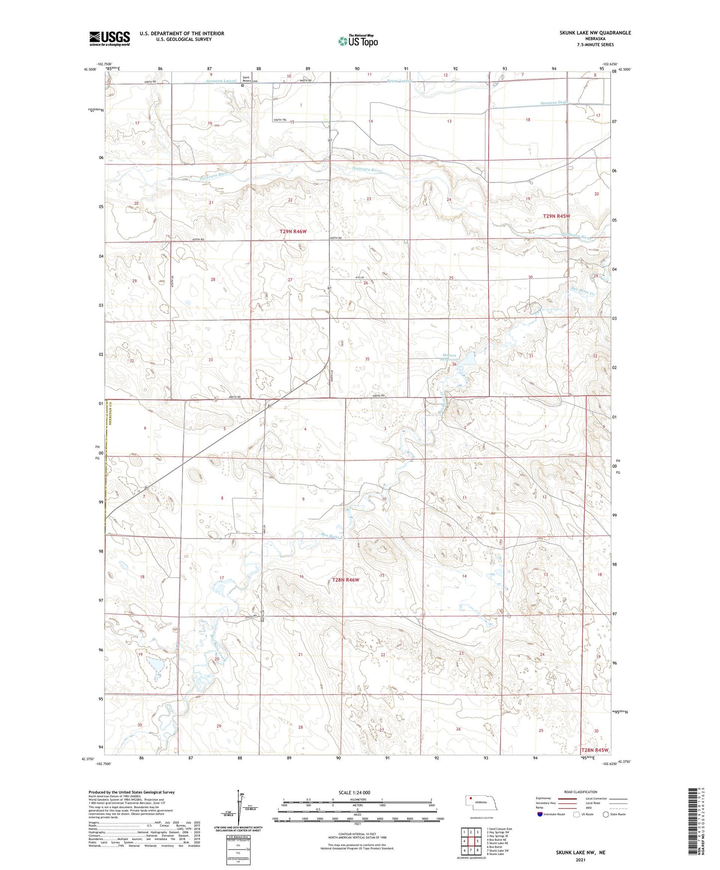
2021 topographic map quadrangle Skunk Lake NW in the state of Nebraska. Scale: 1:24000. Based on the newly updated USGS 7.5' US Topo map series, this map is in the following counties: Sheridan, Box Butte. The map contains contour data, water features, and other items you are used to seeing on USGS maps, but also has updated roads and other features. This is the next generation of topographic maps. Printed on high-quality waterproof paper with UV fade-resistant inks.
Quads adjacent to this one:
West: Box Butte NE
Northwest: Sand Canyon East
North: Hay Springs SW
Northeast: Hay Springs SE
East: Skunk Lake NE
Southeast: Skunk Lake
South: Skunk Lake SW
Southwest: Box Butte
This map covers the same area as the classic USGS quad with code o42102d6.
Contains the following named places: Heaton Dam, Heaton Reservoir, Marple, Marple Post Office, Mirage Election Precinct, Mirage Flats Public School, Peters Lateral, Saint Peters Cemetery, School Number 30, School Number 65, School Number 93, Sturgeon Lateral