MyTopo
Spalding Nebraska US Topo Map
Couldn't load pickup availability
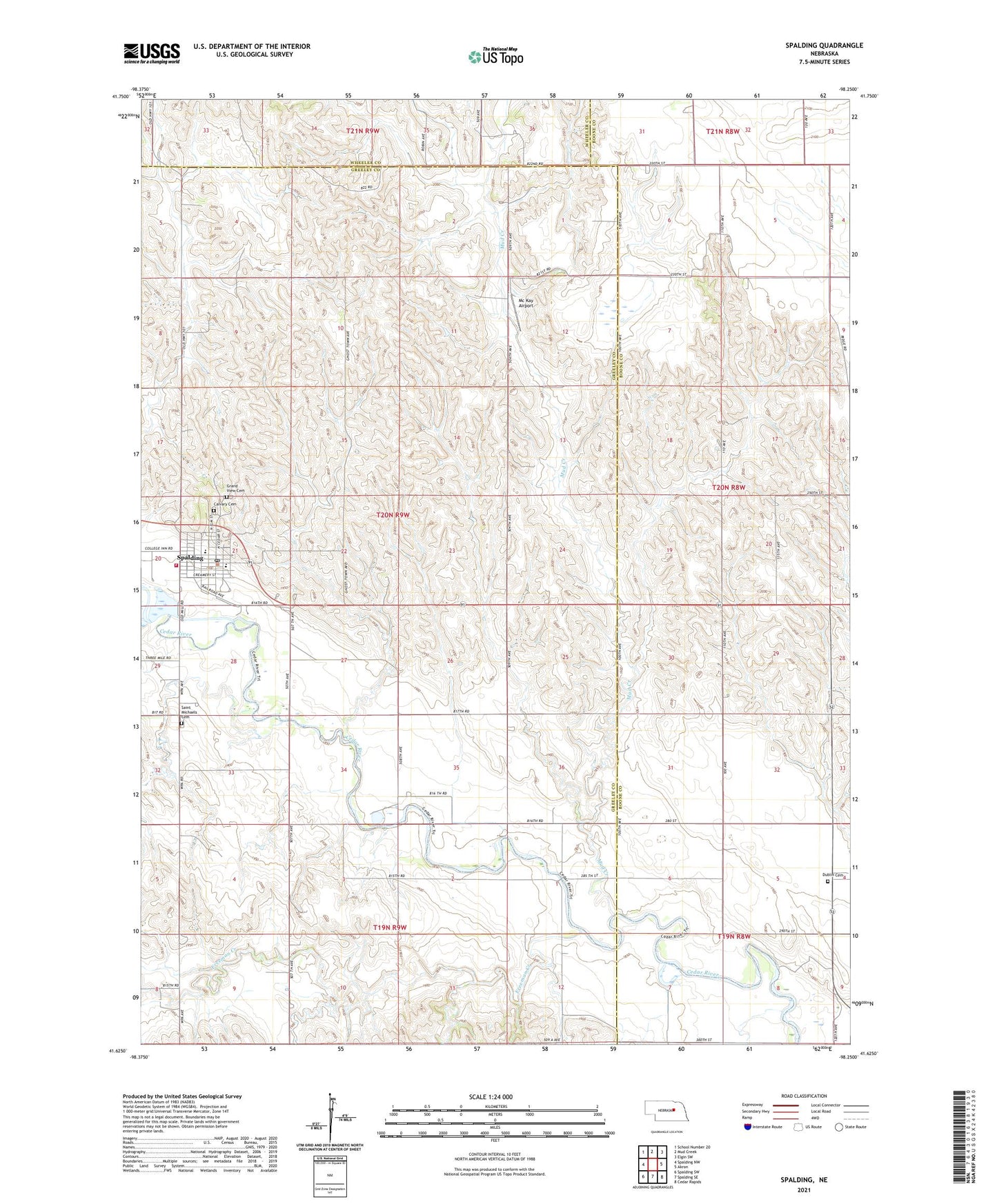
2021 topographic map quadrangle Spalding in the state of Nebraska. Scale: 1:24000. Based on the newly updated USGS 7.5' US Topo map series, this map is in the following counties: Greeley, Boone, Wheeler. The map contains contour data, water features, and other items you are used to seeing on USGS maps, but also has updated roads and other features. This is the next generation of topographic maps. Printed on high-quality waterproof paper with UV fade-resistant inks.
Quads adjacent to this one:
West: Spalding NW
Northwest: School Number 20
North: Mud Creek
Northeast: Elgin SW
East: Akron
Southeast: Cedar Rapids
South: Spalding SE
Southwest: Spalding SW
This map covers the same area as the classic USGS quad with code o41098f3.
Contains the following named places: Calvary Cemetery, Dublin Cemetery, Freeman Creek, Friendship Villa, Glaser Airport, Grand View Cemetery, Mc Kay Airport, Mud Creek, Saint Michaels Catholic Church, Saint Michaels Cemetery, School Number 22, School Number 35, School Number 39, School Number 4, School Number 47, School Number 70, South Akron Public School, Spalding, Spalding Academy, Spalding City Park, Spalding City Park Campground, Spalding Community Clinic, Spalding Cooperative Elevator, Spalding Dam Site Campground, Spalding Post Office, Spalding Public Library, Spalding Public Schools, Spalding Volunteer Fire and Rescue, Village of Spalding