MyTopo
Sparta Nebraska US Topo Map
Couldn't load pickup availability
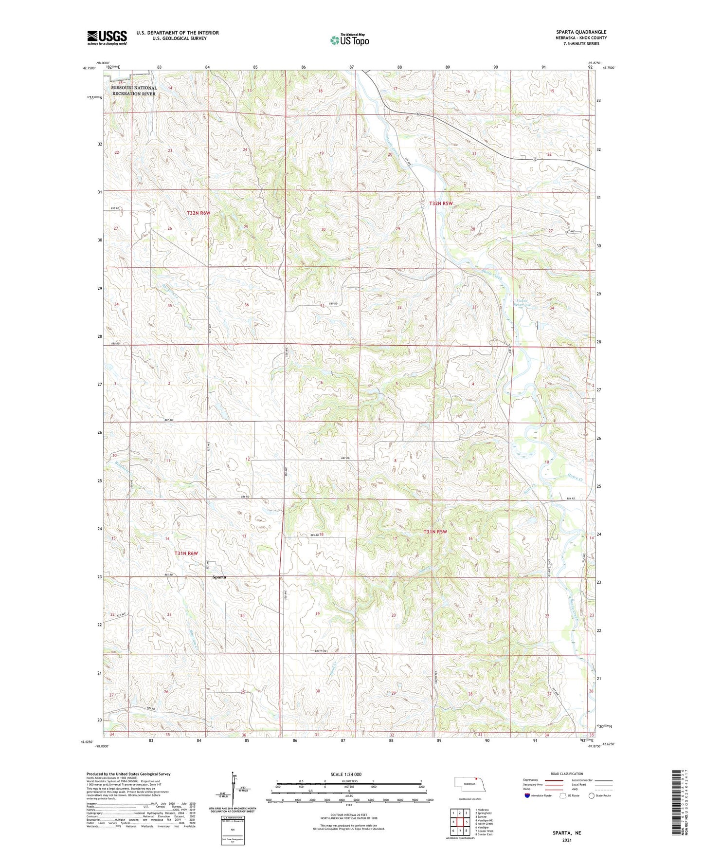
2021 topographic map quadrangle Sparta in the state of Nebraska. Scale: 1:24000. Based on the newly updated USGS 7.5' US Topo map series, this map is in the following counties: Knox. The map contains contour data, water features, and other items you are used to seeing on USGS maps, but also has updated roads and other features. This is the next generation of topographic maps. Printed on high-quality waterproof paper with UV fade-resistant inks.
Quads adjacent to this one:
West: Verdigre NE
North: Springfield
Northeast: Santee
East: Howe Creek
Southeast: Center East
South: Center West
Southwest: Verdigre
Contains the following named places: Bazile Creek Church, Howe Creek, Knox County, Sand Creek, Sparta, Sparta Post Office, Township of Spade, Township of Union, Vakoc Dam, Vakoc Reservoir, ZIP Code: 68724