MyTopo
Strang Nebraska US Topo Map
Couldn't load pickup availability
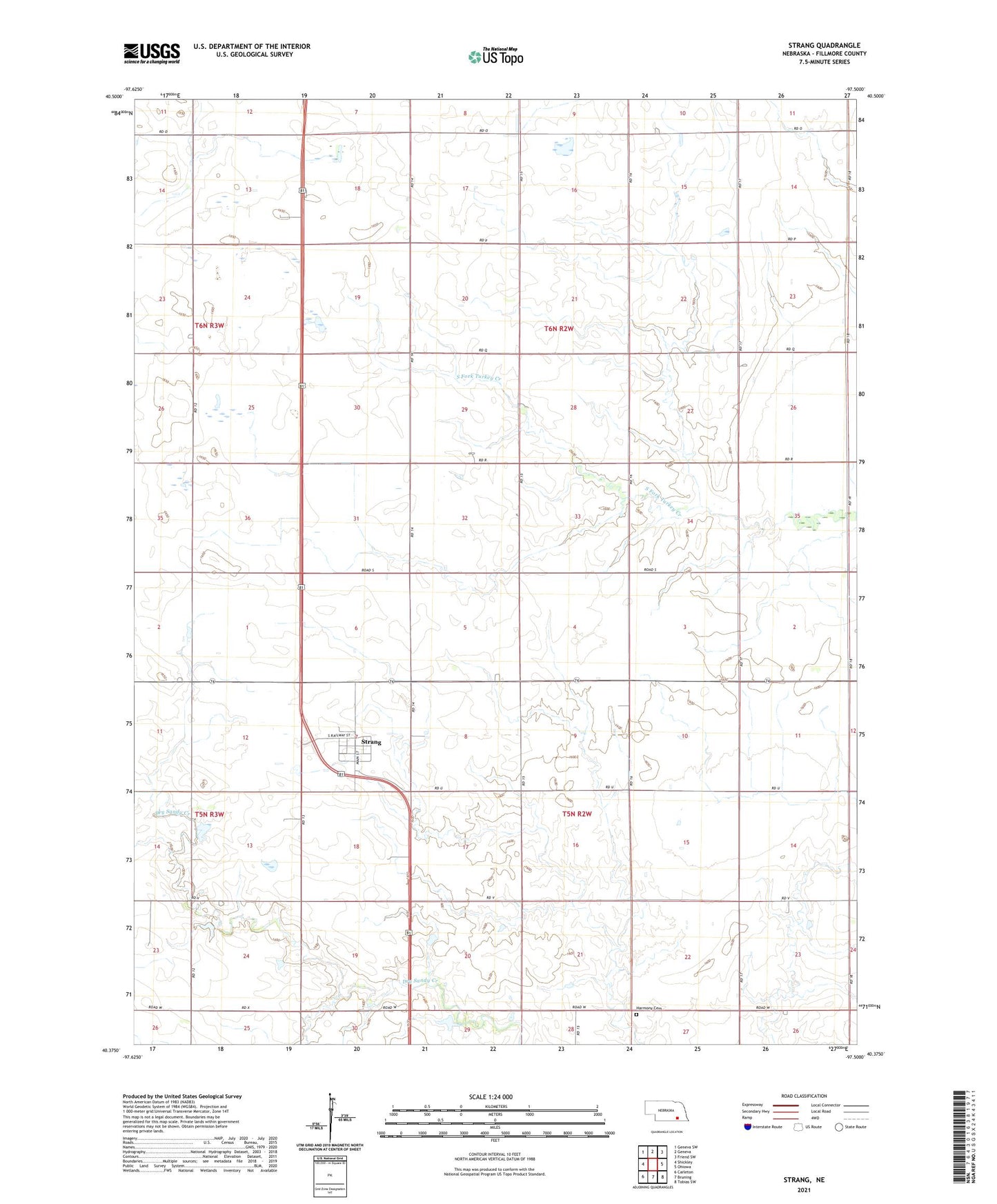
2021 topographic map quadrangle Strang in the state of Nebraska. Scale: 1:24000. Based on the newly updated USGS 7.5' US Topo map series, this map is in the following counties: Fillmore. The map contains contour data, water features, and other items you are used to seeing on USGS maps, but also has updated roads and other features. This is the next generation of topographic maps. Printed on high-quality waterproof paper with UV fade-resistant inks.
Quads adjacent to this one:
West: Shickley
Northwest: Geneva SW
North: Geneva
Northeast: Friend SW
East: Ohiowa
Southeast: Tobias SW
South: Bruning
Southwest: Carleton
Contains the following named places: East Strang Junction, Harmony Cemetery, Strang, Strang Post Office, Strang Public Library, Strang Public School, Township of Belle Prairie, Township of Chelsea, Village of Strang, ZIP Code: 68444