MyTopo
Sutton Nebraska US Topo Map
Couldn't load pickup availability
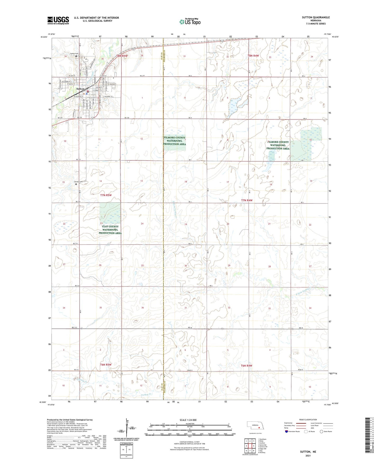
2021 topographic map quadrangle Sutton in the state of Nebraska. Scale: 1:24000. Based on the newly updated USGS 7.5' US Topo map series, this map is in the following counties: Fillmore, Clay. The map contains contour data, water features, and other items you are used to seeing on USGS maps, but also has updated roads and other features. This is the next generation of topographic maps. Printed on high-quality waterproof paper with UV fade-resistant inks.
Quads adjacent to this one:
West: Saronville
Northwest: Stockham
North: Bixby
Northeast: Grafton
East: Geneva SW
Southeast: Shickley
South: Ong
Southwest: Edgar NW
Contains the following named places: Calvary Cemetery, City of Sutton, Emmanuel Reformed Church, Federated Church, Fox Hollow Golf Course, Hope Reformed Church, Lange Lagoon National Wildlife Management Area, McBride Vision Clinic, Rauscher Lagoon Natl Wildlife Mgt Area, Rolland Lagoon N W M A, Saint Marys Catholic Church, Sutton, Sutton Cemetery, Sutton Christian School, Sutton City Park, Sutton Community Home, Sutton Cooperative Grain Company Elevator, Sutton Dental Clinic, Sutton Family Care, Sutton Historical Marker, Sutton Medical Clinic, Sutton Memorial Library, Sutton Police Department, Sutton Post Office, Sutton Public Schools, Sutton Recreational Trail, Sutton Volunteer Ambulance Service, Sutton Volunteer Fire Department, Township of Bennett, ZIP Code: 68979