MyTopo
Stockham Nebraska US Topo Map
Couldn't load pickup availability
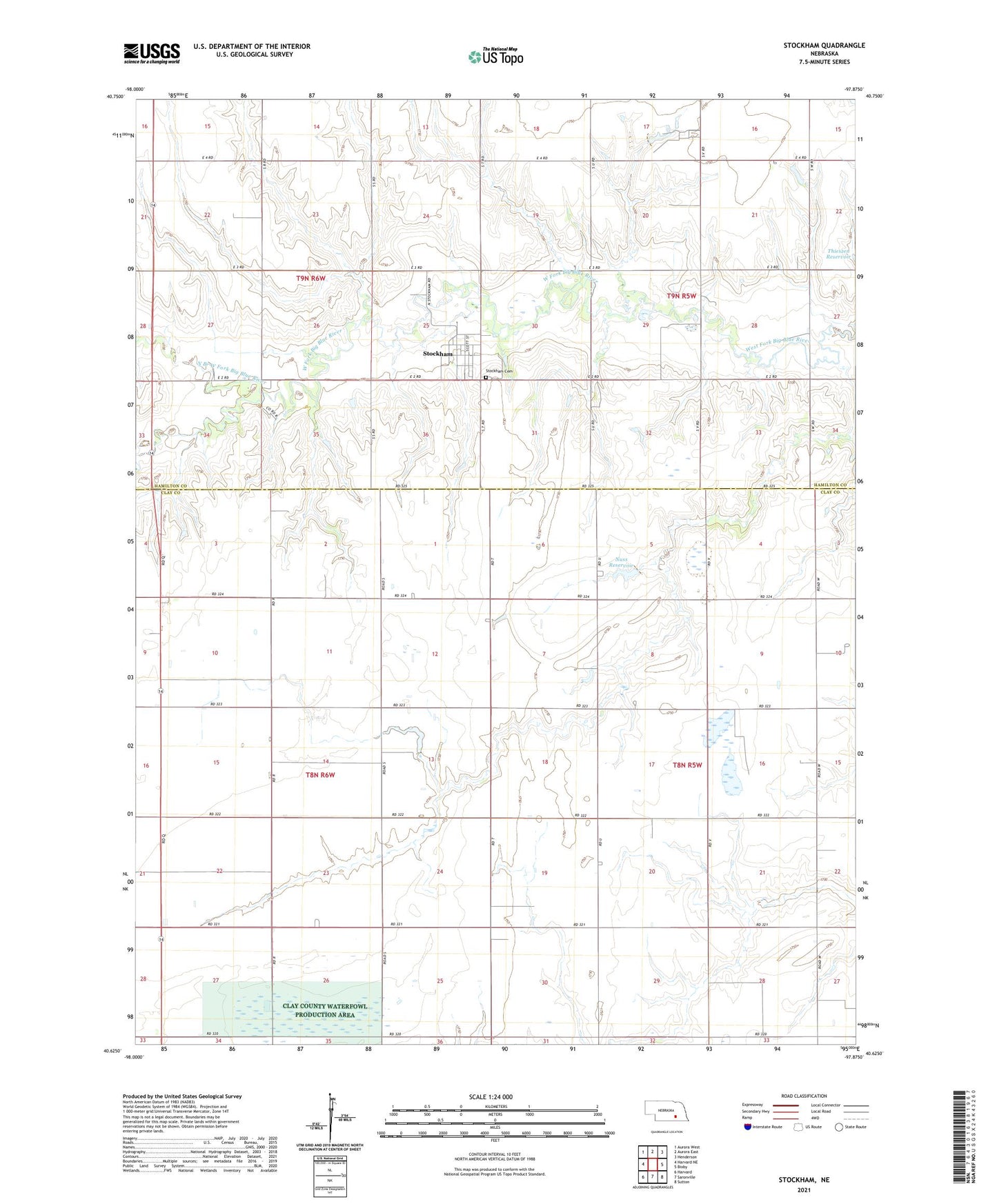
2021 topographic map quadrangle Stockham in the state of Nebraska. Scale: 1:24000. Based on the newly updated USGS 7.5' US Topo map series, this map is in the following counties: Clay, Hamilton. The map contains contour data, water features, and other items you are used to seeing on USGS maps, but also has updated roads and other features. This is the next generation of topographic maps. Printed on high-quality waterproof paper with UV fade-resistant inks.
Quads adjacent to this one:
West: Harvard NE
Northwest: Aurora West
North: Aurora East
Northeast: Henderson
East: Bixby
Southeast: Sutton
South: Saronville
Southwest: Harvard
This map covers the same area as the classic USGS quad with code o40097f8.
Contains the following named places: Eldorado, Eldorado Post Office, Election Precinct 1, North Branch West Fork Big Blue River, Nuss Dam, Nuss Reservoir, Rainwater Basin Wildlife Management District, Sandpiper Federal Waterfowl Production Area, Stockham, Stockham Cemetery, Stockham City School, Stockham Community Church, Stockham Post Office, Township of Eldorado, Township of Farmers Valley, Township of Orville, Township of School Creek, Village of Stockham