MyTopo
Taylor Nebraska US Topo Map
Couldn't load pickup availability
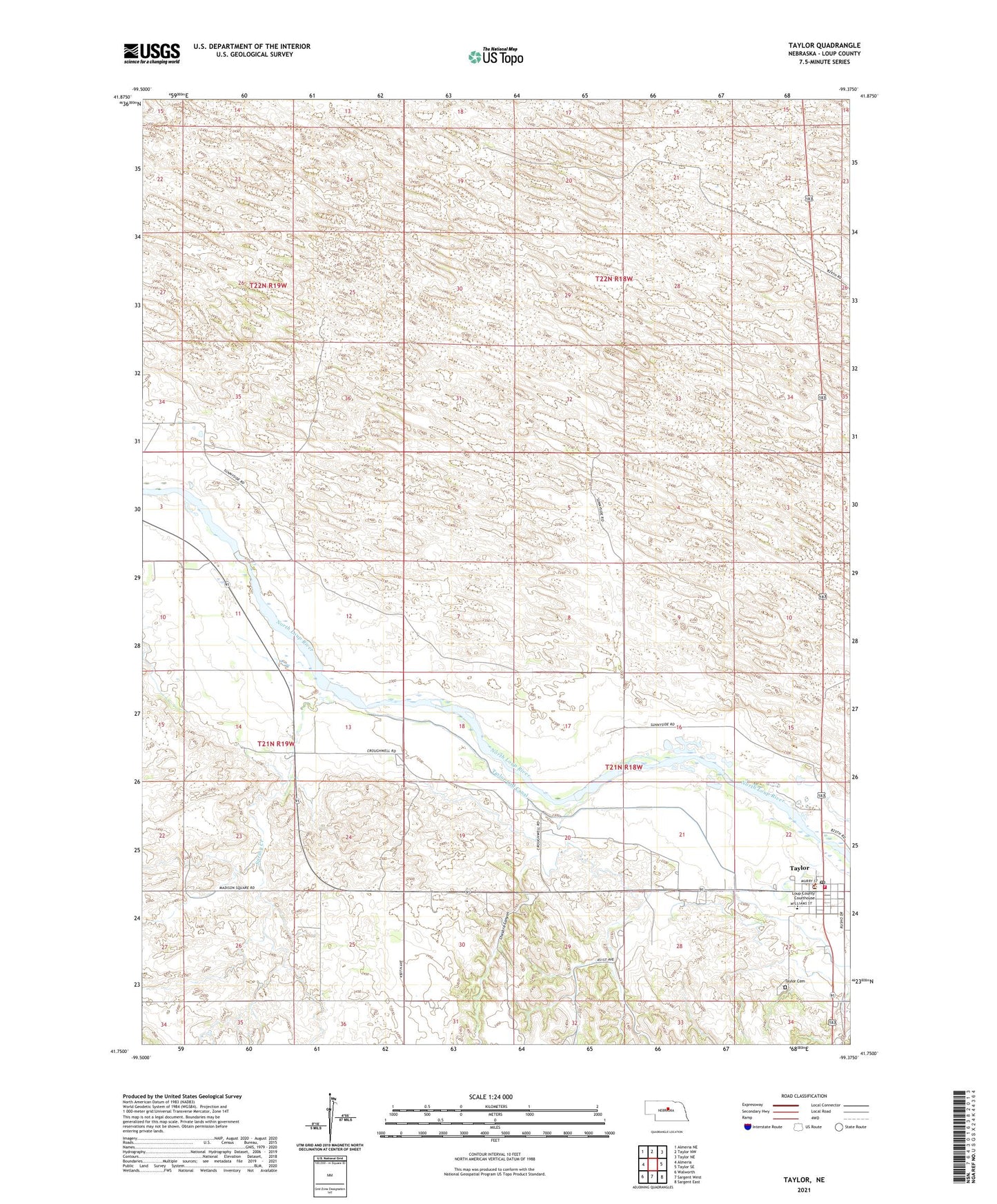
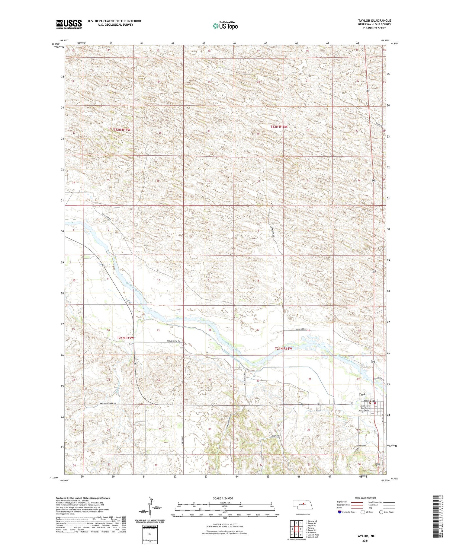
2021 topographic map quadrangle Taylor in the state of Nebraska. Scale: 1:24000. Based on the newly updated USGS 7.5' US Topo map series, this map is in the following counties: Loup. The map contains contour data, water features, and other items you are used to seeing on USGS maps, but also has updated roads and other features. This is the next generation of topographic maps. Printed on high-quality waterproof paper with UV fade-resistant inks.
Quads adjacent to this one:
West: Almeria
Northwest: Almeria NE
North: Taylor NW
Northeast: Taylor NE
East: Taylor SE
Southeast: Sargent East
South: Sargent West
Southwest: Walworth
Contains the following named places: Assembly of God Church, Britton Ranch, Calvary United Methodist Church, Chesbra Canyon, Hawthorne Ranch, Loup County Ambulance, Loup County Fairgrounds, Loup County Public Schools, Loup County Sheriff's Office, Loup County Volunteer Fire and Rescue Squad, Marcia Smith Auditorium, McGraw Ranch, Pioneer Memorial Log Cabin Museum, Spring Creek, Sunnyside School, Taylor, Taylor Cemetery, Taylor City Library, Taylor Dam, Taylor Evangelical Free Church, Taylor Post Office, Taylor Tourist Park, Taylor-Ord Diversion Dam, Taylor-Ord Diversion Reservoir, Township of Taylor, Village of Taylor, Wayne Plugge Memorial Arena, Worm Ranch