MyTopo
Tin Camp Ranch Nebraska US Topo Map
Couldn't load pickup availability
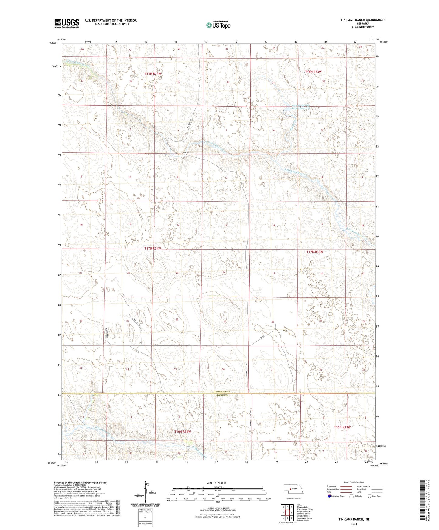
2023 topographic map quadrangle Tin Camp Ranch in the state of Nebraska. Scale: 1:24000. Based on the newly updated USGS 7.5' US Topo map series, this map is in the following counties: McPherson, Lincoln. The map contains contour data, water features, and other items you are used to seeing on USGS maps, but also has updated roads and other features. This is the next generation of topographic maps. Printed on high-quality waterproof paper with UV fade-resistant inks.
Quads adjacent to this one:
West: Big Bald Hill NE
Northwest: Flats
North: Snyder Lake
Northeast: Schneringer Valley
East: Pierson Ranch
Southeast: Green Ranch
South: Applegate Ranch
Southwest: Big Bald Hill SE
This map covers the same area as the classic USGS quad with code o41101d2.
Contains the following named places: Charles Morgan Ranch, Gale Morgan Ranch, Harshfield Ranch, Pawnee Springs Ranch Dam, Pawnee Springs Ranch Reservoir, Richardson Ranch, Squaw Creek, Tin Camp Ranch