MyTopo
Tobias Nebraska US Topo Map
Couldn't load pickup availability
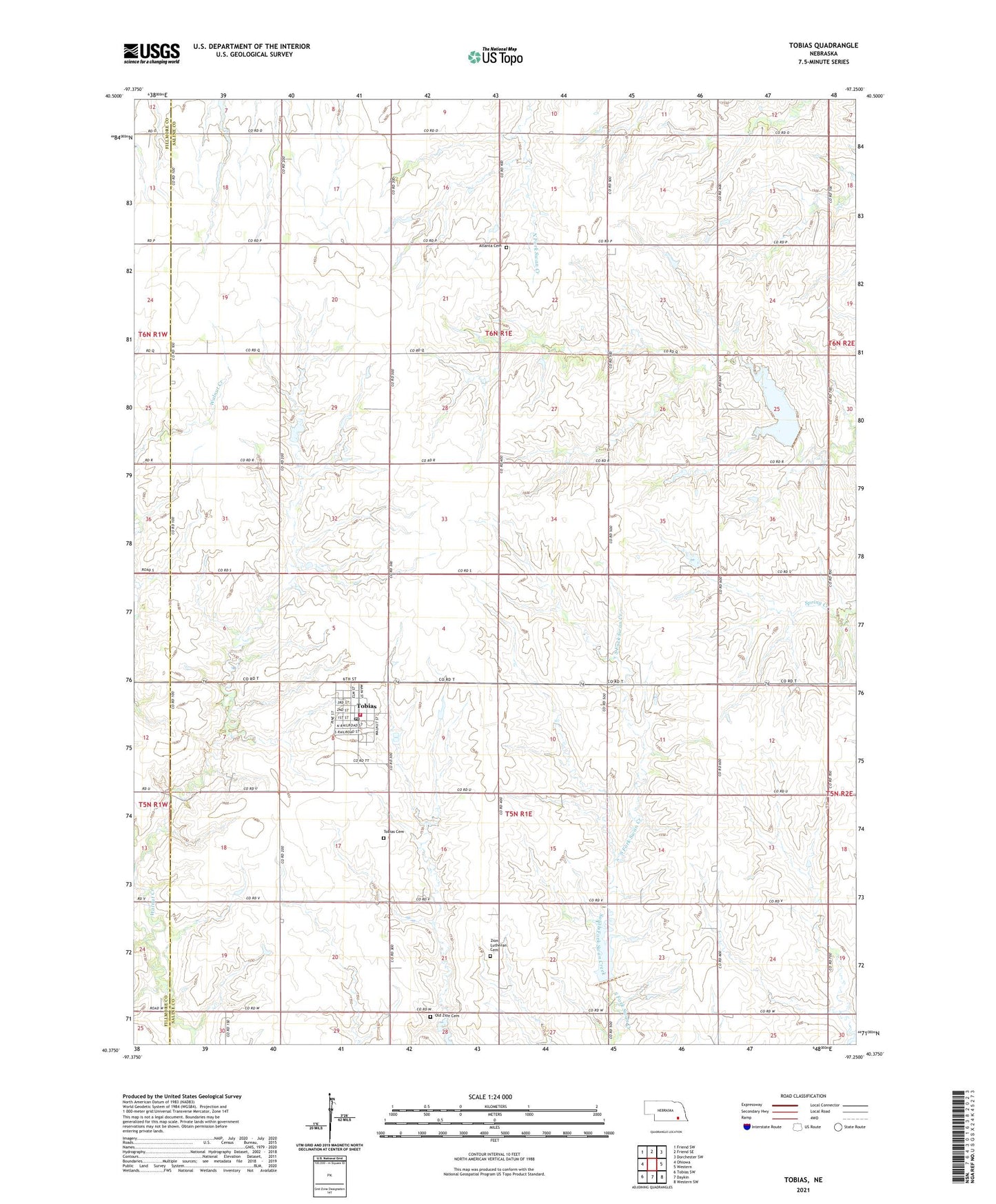
2021 topographic map quadrangle Tobias in the state of Nebraska. Scale: 1:24000. Based on the newly updated USGS 7.5' US Topo map series, this map is in the following counties: Saline, Fillmore. The map contains contour data, water features, and other items you are used to seeing on USGS maps, but also has updated roads and other features. This is the next generation of topographic maps. Printed on high-quality waterproof paper with UV fade-resistant inks.
Quads adjacent to this one:
West: Ohiowa
Northwest: Friend SW
North: Friend SE
Northeast: Dorchester SW
East: Western
Southeast: Western SW
South: Daykin
Southwest: Tobias SW
Contains the following named places: Atlanta Cemetery, Atlanta Election Precinct, Farmers Co-op Association Elevator, Old Zion Cemetery, Olive Election Precinct, Saint Joseph Catholic Church, Sergeant Leodegar Schnyder Historical Marker, Tobias, Tobias Cemetery, Tobias Community Church, Tobias Community Historical Museum, Tobias Post Office, Tobias Public Library, Tobias Volunteer Fire and Rescue, Township of Atlanta, Township of Olive, Village of Tobias, Ward School, Zion Lutheran Cemetery, Zion School, ZIP Code: 68453