MyTopo
Western Nebraska US Topo Map
Couldn't load pickup availability
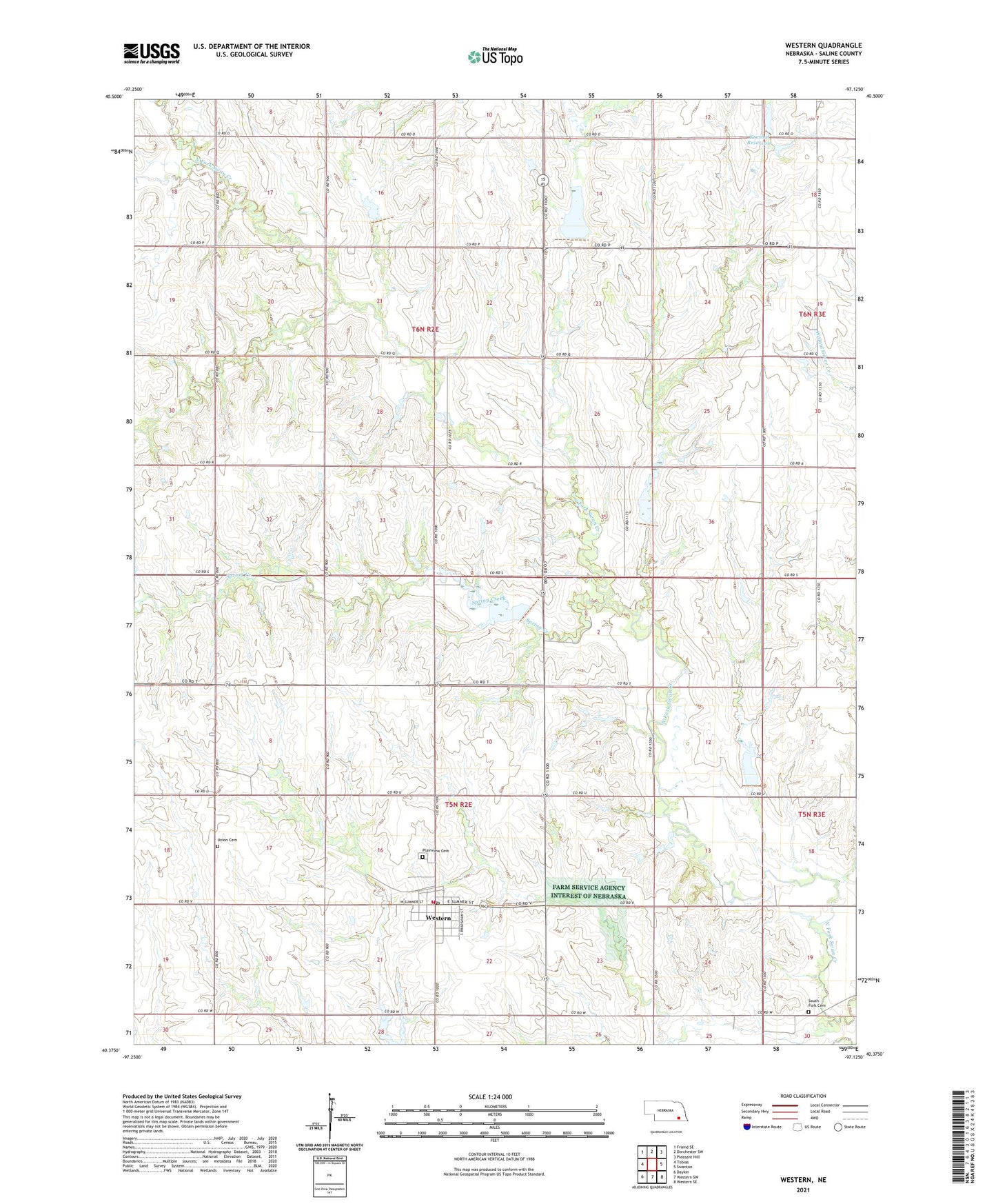
2021 topographic map quadrangle Western in the state of Nebraska. Scale: 1:24000. Based on the newly updated USGS 7.5' US Topo map series, this map is in the following counties: Saline. The map contains contour data, water features, and other items you are used to seeing on USGS maps, but also has updated roads and other features. This is the next generation of topographic maps. Printed on high-quality waterproof paper with UV fade-resistant inks.
Quads adjacent to this one:
West: Tobias
Northwest: Friend SE
North: Dorchester SW
Northeast: Pleasant Hill
East: Swanton
Southeast: Western SE
South: Western SW
Southwest: Daykin
This map covers the same area as the classic USGS quad with code o40097d2.
Contains the following named places: Farmers Cooperative Elevators, First Baptist Church, Kreshal Dam, Kreshal Reservoir, North Fork Election Precinct, Plainview Cemetery, Saint Johns United Church of Christ, South Fork Cemetery, South Fork Election Precinct, Spring Creek, Struckman-Baatz Memorial Library, Swan Valley School, Township of North Fork, Township of South Fork, Union Cemetery, United Methodist Church, Village of Western, Western, Western City Park, Western Post Office, Western Public School, Western Village Park Campground, Western Volunteer Fire Department, ZIP Code: 68464