MyTopo
Western SW Nebraska US Topo Map
Couldn't load pickup availability
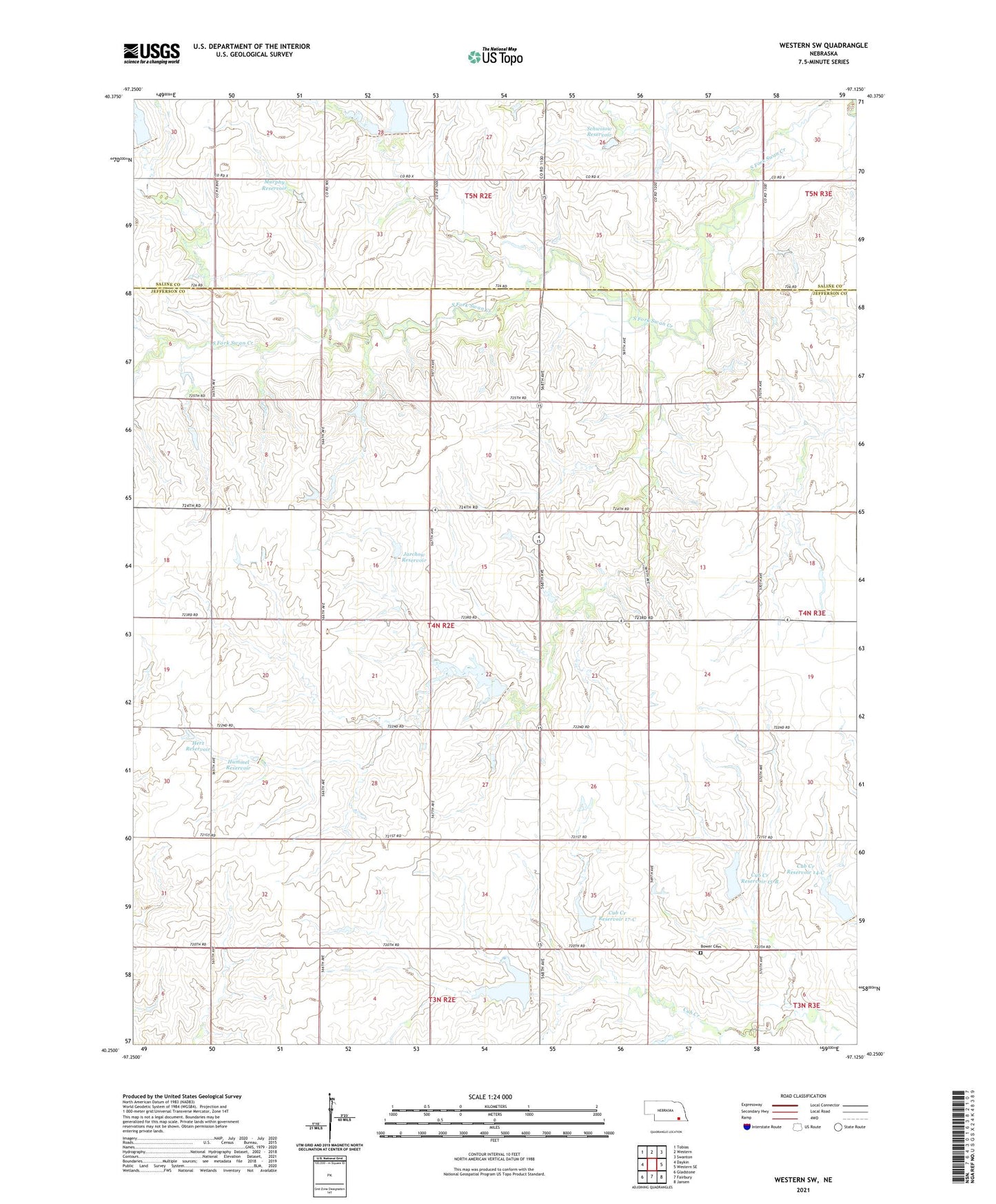
2021 topographic map quadrangle Western SW in the state of Nebraska. Scale: 1:24000. Based on the newly updated USGS 7.5' US Topo map series, this map is in the following counties: Jefferson, Saline. The map contains contour data, water features, and other items you are used to seeing on USGS maps, but also has updated roads and other features. This is the next generation of topographic maps. Printed on high-quality waterproof paper with UV fade-resistant inks.
Quads adjacent to this one:
West: Daykin
Northwest: Tobias
North: Western
Northeast: Swanton
East: Western SE
Southeast: Jansen
South: Fairbury
Southwest: Gladstone
This map covers the same area as the classic USGS quad with code o40097c2.
Contains the following named places: Bower, Bower Cemetery, Bower Post Office, Bower School, Cub Creek Dam 14-C, Cub Creek Dam 17-A, Cub Creek Reservoir 14-C, Cub Creek Reservoir 15-B, Cub Creek Reservoir 17-A, Cub Creek Reservoir 17-C, Detention Dam 17-C, East Bower School, Floodwater Retarding Dam 15-B, Four Corners School, Harold Hummel Erosion Control Dam, Herz Pohlmeier Dam, Herz Reservoir, Hummel Reservoir, Immanuel Church, Jarchow Dam, Jarchow Reservoir, Murphy Dam, Murphy Reservoir, Schwisow Dam, Schwisow Reservoir, Township of Washington, Victory School, Washington Election Precinct