MyTopo
Verdigre Nebraska US Topo Map
Couldn't load pickup availability
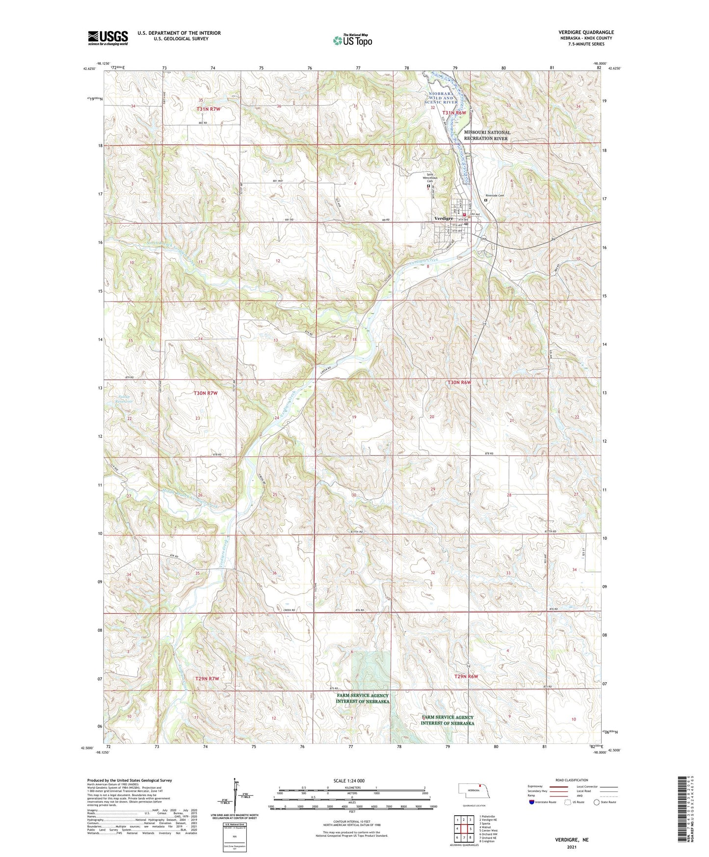
2021 topographic map quadrangle Verdigre in the state of Nebraska. Scale: 1:24000. Based on the newly updated USGS 7.5' US Topo map series, this map is in the following counties: Knox. The map contains contour data, water features, and other items you are used to seeing on USGS maps, but also has updated roads and other features. This is the next generation of topographic maps. Printed on high-quality waterproof paper with UV fade-resistant inks.
Quads adjacent to this one:
West: Walnut
Northwest: Pishelville
North: Verdigre NE
Northeast: Sparta
East: Center West
Southeast: Creighton
South: Orchard NE
Southwest: Orchard NW
Contains the following named places: Alpine Village of Verdigre, Bethlehem Lutheran Church, Historic Grist Mill, Middle Branch Verdigre Creek, North Branch Verdigre Creek, Oak Valley School, Pleasant Hill School, Riverside Cemetery, Saint Wenceslaus Catholic Church, Saint Wenceslaus Cemetery, School Number 24, School Number 39, Sukup Reservoir, Township of Verdigre, United Methodist Church, Verdigre, Verdigre Heritage Museum, Verdigre Police Department, Verdigre Post Office, Verdigre Public Library, Verdigre Public School, Verdigre Volunteer Fire Department, Verdigre Volunteer Rescue Squad, Veterans Memorial Park, Village of Verdigre, Wildwood Acres Campground, Wildwood Acres Park