MyTopo
Verdon Nebraska US Topo Map
Couldn't load pickup availability
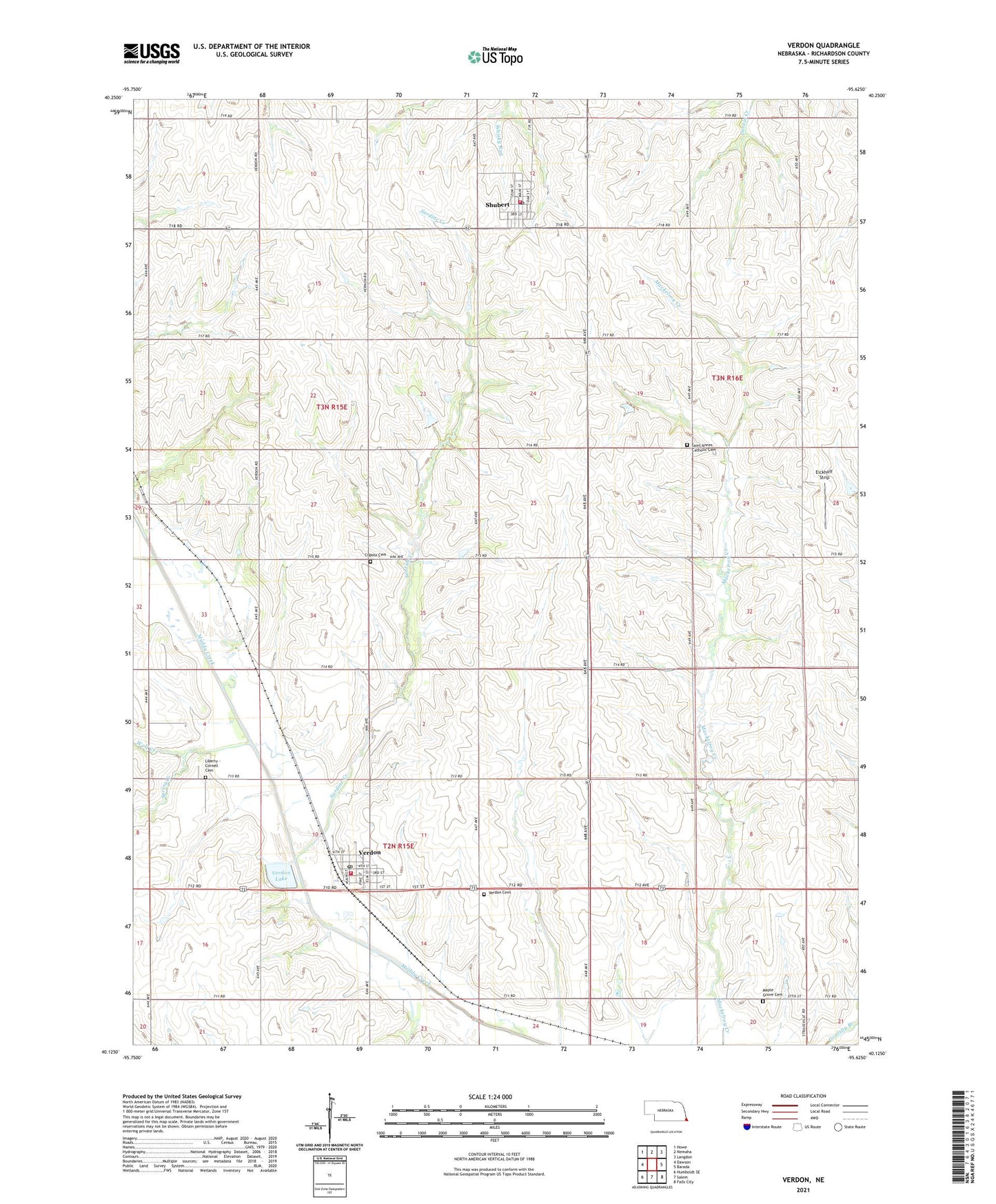
2021 topographic map quadrangle Verdon in the state of Nebraska. Scale: 1:24000. Based on the newly updated USGS 7.5' US Topo map series, this map is in the following counties: Richardson. The map contains contour data, water features, and other items you are used to seeing on USGS maps, but also has updated roads and other features. This is the next generation of topographic maps. Printed on high-quality waterproof paper with UV fade-resistant inks.
Quads adjacent to this one:
West: Dawson
Northwest: Howe
North: Nemaha
Northeast: Langdon
East: Barada
Southeast: Falls City
South: Salem
Southwest: Humboldt SE
Contains the following named places: Cupola Cemetery, Deer Creek, East Muddy Election Precinct, Eickhoff Strip, Elkton Post Office, Elmore Post Office, Geneva Post Office, Liberty - Cornell Cemetery, Liberty Election Precinct, Maple Grove Cemetery, Maple Grove School, Parson School, Pleasant Hill School, Richardson County, Saint Ann Catholic Church, Saint Annes Catholic Cemetery, Sardine Creek, Shubert, Shubert Christian Church, Shubert Post Office, Shubert Public Library, Shubert Volunteer Fire Department, Spring Creek, Township of East Muddy, Township of Liberty, Verdon, Verdon Cemetery, Verdon Christian Church, Verdon Dam, Verdon Grain Company Elevator, Verdon Lake, Verdon Lake State Recreation Area, Verdon Post Office, Verdon Volunteer Fire Department, Village of Shubert, Village of Verdon, Village of Verdon Library, W M Grain Company Elevator, Wolf Creek, ZIP Codes: 68437, 68457