
MyTopo
Wahoo SE Nebraska US Topo Map
Couldn't load pickup availability
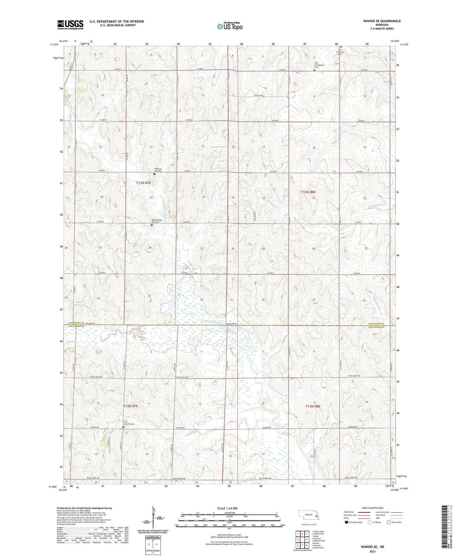
2021 topographic map quadrangle Wahoo SE in the state of Nebraska. Scale: 1:24000. Based on the newly updated USGS 7.5' US Topo map series, this map is in the following counties: Saunders, Lancaster. The map contains contour data, water features, and other items you are used to seeing on USGS maps, but also has updated roads and other features. This is the next generation of topographic maps. Printed on high-quality waterproof paper with UV fade-resistant inks.
Quads adjacent to this one:
West: Ceresco
Northwest: Wahoo West
North: Wahoo East
Northeast: Mead
East: Ashland West
Southeast: Greenwood
South: Waverly
Southwest: Davey
Contains the following named places: Bornmann Field, Cedar Hill Church, Free Church Cemetery, Jack Sinn Memorial State Wildlife Management Area, Martin Dam, Martin Reservoir, Mill Election Precinct, North Fork Rock Creek, Old Pleasant Hill Cemetery, Pioneer State Recreation Area, Pleasant Hill Cemetery, Rock Creek Election Precinct, School Number 102, School Number 52, Township of Green, Township of Richland, Zion Church, Zion Evangelical Cemetery, Zion Lutheran Cemetery, ZIP Code: 68033


