MyTopo
Mead Nebraska US Topo Map
Couldn't load pickup availability
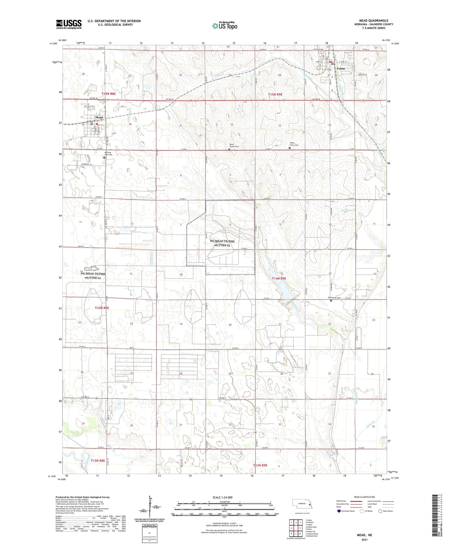
2021 topographic map quadrangle Mead in the state of Nebraska. Scale: 1:24000. Based on the newly updated USGS 7.5' US Topo map series, this map is in the following counties: Saunders. The map contains contour data, water features, and other items you are used to seeing on USGS maps, but also has updated roads and other features. This is the next generation of topographic maps. Printed on high-quality waterproof paper with UV fade-resistant inks.
Quads adjacent to this one:
West: Wahoo East
Northwest: Colon
North: Leshara
Northeast: Valley
East: Wann
Southeast: Ashland East
South: Ashland West
Southwest: Wahoo SE
This map covers the same area as the classic USGS quad with code o41096b4.
Contains the following named places: Alma Lutheran Church, City of Yutan, Hollst - Lawn Cemetery, Johnson Creek, Johnson Creek Dam 22-A, Johnson Creek Reservoir 22-A, KUON-TV (Lincoln), Mead, Mead Covenant Church, Mead Police Department, Mead Post Office, Mead Public Library, Mead Public Schools, Mead Volunteer Fire and Rescue Department, Morning Side Cemetery, Parmenter Cemetery, Saint James Catholic Church, Saint James Cemetery, Saint Johns Lutheran Church, Saint Peters United Church of Christ, Township of Marble, University of Nebraska Field Lab, Upper Clear Creek, Village of Mead, Yutan, Yutan Country Club, Yutan Elementary School, Yutan Family Dentistry, Yutan High School, Yutan Oto Indian Village Historical Marker, Yutan Police Department, Yutan Post Office, Yutan Public Library, Yutan Volunteer Fire Department, ZIP Code: 68041