MyTopo
Wahoo West Nebraska US Topo Map
Couldn't load pickup availability
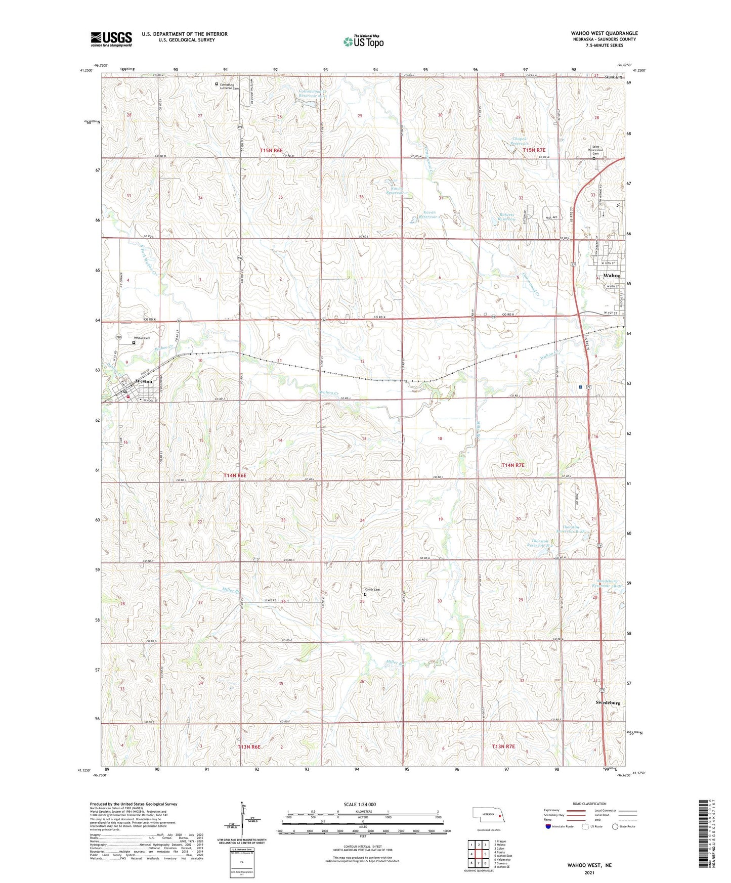
2021 topographic map quadrangle Wahoo West in the state of Nebraska. Scale: 1:24000. Based on the newly updated USGS 7.5' US Topo map series, this map is in the following counties: Saunders. The map contains contour data, water features, and other items you are used to seeing on USGS maps, but also has updated roads and other features. This is the next generation of topographic maps. Printed on high-quality waterproof paper with UV fade-resistant inks.
Quads adjacent to this one:
West: Touhy
Northwest: Prague
North: Malmo
Northeast: Colon
East: Wahoo East
Southeast: Wahoo SE
South: Ceresco
Southwest: Valparaiso
This map covers the same area as the classic USGS quad with code o41096b6.
Contains the following named places: Chapek Dam, Chapek Reservoir, Cottonwood Creek, Cottonwood Creek Dam 23-A, Cottonwood Creek Reservoir 23-A, Czech Cemetery, Czech Church, Dunlap Creek, Edensburg Lutheran Cemetery, First Presbyterian Church, Hackberry Park, Haven House, Hilltop Country Club, John F Kennedy College, Kavan Dam 1, Kavan Dam 2, Kavan Reservoir 1, Kavan Reservoir 2, Miller Branch, North Fork Wahoo Creek, Our Reddemer Lutheran Church, Roberts Dam, Roberts Reservoir, Saint John Elementary School, Saint John Nepomucene Catholic Church, Saint Wenceslaus Cemetery, Saunders County, Saunders County Care Center, Saunders Medical Center, School Number 44, School Number 62, School Number 7, School Number 87, South Center Public School, Swedeburg Dam 2B-2F, Swedeburg Reservoir 2B-2F, Thorston Dam B-2, Thorston Dam B-2A, Thorston Reservoir B-2, Thorston Reservoir B-2A, Township of Chapman, Triangle Park, Village of Weston, Wahoo High School, Wahoo Medical Clinic, Wahoo Middle School, Wahoo Physicians Clinic, West Ward Elementary School, Weston, Weston Cemetery, Weston Fire and Rescue, Weston Post Office, Weston Public School, ZIP Code: 68066