MyTopo
Blue Nose Peak Nevada US Topo Map
Couldn't load pickup availability
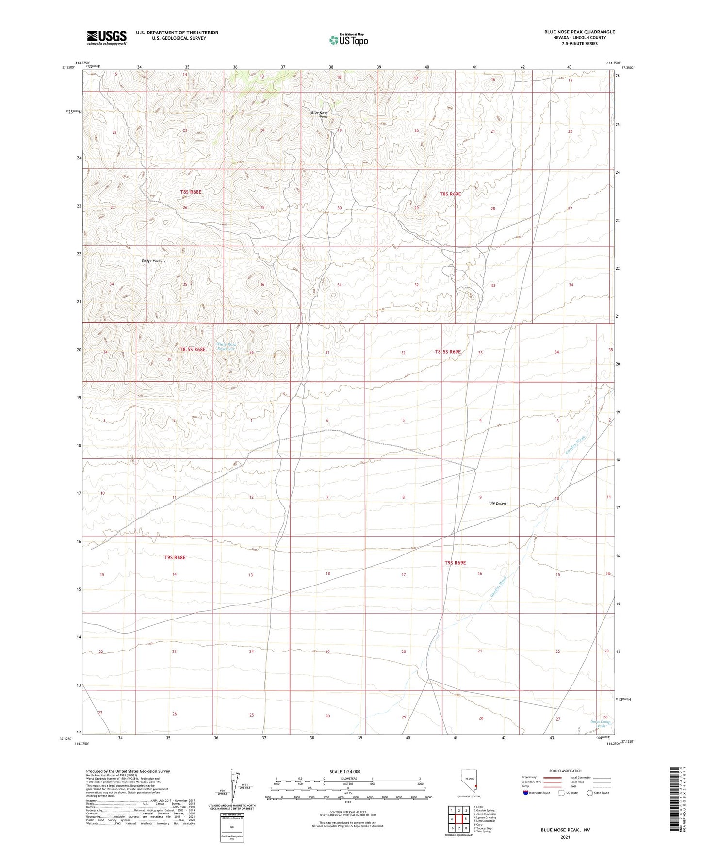
2021 topographic map quadrangle Blue Nose Peak in the state of Nevada. Scale: 1:24000. Based on the newly updated USGS 7.5' US Topo map series, this map is in the following counties: Lincoln. The map contains contour data, water features, and other items you are used to seeing on USGS maps, but also has updated roads and other features. This is the next generation of topographic maps. Printed on high-quality waterproof paper with UV fade-resistant inks.
Quads adjacent to this one:
West: Lyman Crossing
Northwest: Leith
North: Garden Spring
Northeast: Jacks Mountain
East: Lime Mountain
Southeast: Tule Spring
South: Toquop Gap
Southwest: Carp
This map covers the same area as the classic USGS quad with code o37114b3.
Contains the following named places: Blue Nose Peak, Crystal Mine, Dodge Pocket Reservoir, Dodge Pockets, Dodge Pockets Dams, End of the Line Trough, Garden Springs Pipe Line, Johnnie Mine, Pittsburg Mine, Tule Desert, Viola Mining District, Wells Cargo Mine, Wests Camp, White Rock Reservoir