MyTopo
Boulder City NW Nevada US Topo Map
Couldn't load pickup availability
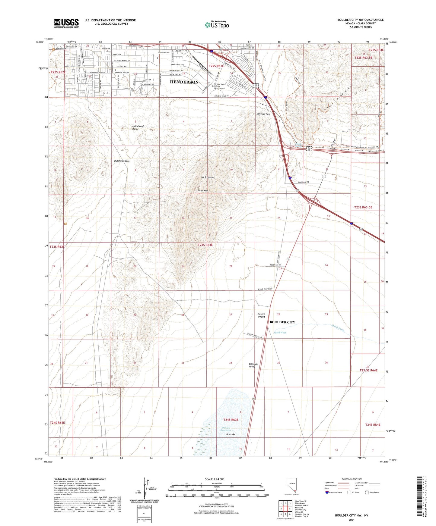
2021 topographic map quadrangle Boulder City NW in the state of Nevada. Scale: 1:24000. Based on the newly updated USGS 7.5' US Topo map series, this map is in the following counties: Clark. The map contains contour data, water features, and other items you are used to seeing on USGS maps, but also has updated roads and other features. This is the next generation of topographic maps. Printed on high-quality waterproof paper with UV fade-resistant inks.
Quads adjacent to this one:
West: Sloan NE
Northwest: Las Vegas SE
North: Henderson
Northeast: Boulder Beach
East: Boulder City
Southeast: Boulder City SE
South: Boulder City SW
Southwest: Sloan SE
Contains the following named places: Alunite, Alunite Mine, Alunite Mining District, Black Hill, Blue Quartz Mine, Dutchman Pass, Jack and Terry Mannion Middle School, KGZA-AM (Boulder City), Klinger Spring, KROL-AM (East Las Vegas), Lucky Dutchman Mine, Marlan J Walker Elementary School, Mission Hills Park, Mount Scorpion, Nevada State College Main Campus, Quail Wash, Quo Vadis Mine, Railroad Pass, Spearhead Mine, Texas Acres, ZIP Code: 89002