MyTopo
Boulder Beach Nevada US Topo Map
Couldn't load pickup availability
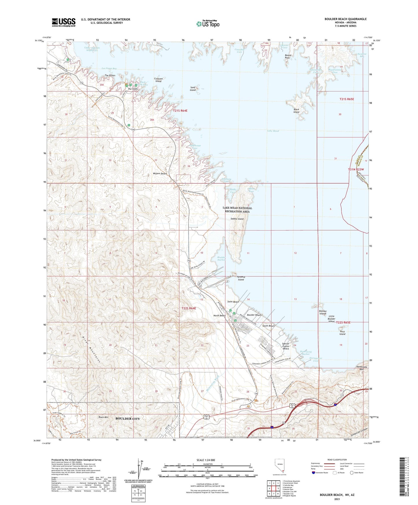
2021 topographic map quadrangle Boulder Beach in the state of Nevada. Scale: 1:24000. Based on the newly updated USGS 7.5' US Topo map series, this map is in the following counties: Clark, Mohave. The map contains contour data, water features, and other items you are used to seeing on USGS maps, but also has updated roads and other features. This is the next generation of topographic maps. Printed on high-quality waterproof paper with UV fade-resistant inks.
Quads adjacent to this one:
West: Henderson
Northwest: Frenchman Mountain
North: Government Wash
Northeast: Callville Bay
East: Hoover Dam
Southeast: Ringbolt Rapids
South: Boulder City
Southwest: Boulder City NW
This map covers the same area as the classic USGS quad with code o36114a7.
Contains the following named places: Alan Bible Visitor Center, Alfred Merritt Smith Water Treatment Plant, Big Boulder Island, Black Island, Black Mountain, Boulder Basin, Boulder Beach, Boulder Beach Campground, Boulder Canyon Project, Boulder Canyon Project Federal Reservation, Boulder City Lateral, Boulder Harbor, Boulder Islands, Boxcar Cove, Boxcar Rock, Crescent Island, Crowe, Deadmans Island, Fredellen, Gravel Plant, Hart Siding, Hatchery Cove, Hemenway Campground, Hemenway Harbor, Hemenway Wash, Horsepower Cove, Junction City, Lake Mead Lodge, Lake Mead Marina, Lakeview Point, Las Vegas Bay, Lawler, Little Boulder Island, McClanahan Mining District, Middle Boulder Island, Moon Cove, North Beach, Pitch Fork Cove, Pumphouse Cove, Pumping Plant Number 1a, Pumping Plant Number 2a, Pumping Plant Number 5, Pumping Plant Number One, Pyramid Island, Regulating Tank Number Two, River Mountains, Roadrunner Cove, Rock Island, Saddle Cove, Saddle Island, Salamander Cove, Sand Island, Shea, South Beach, Special Events Beach, Surge Tank Number Two, Swallow Bay, Swim Beach, The Cliffs, The Pillars, Upper Gypsum Wash Cove