MyTopo
Boulder City Nevada US Topo Map
Couldn't load pickup availability
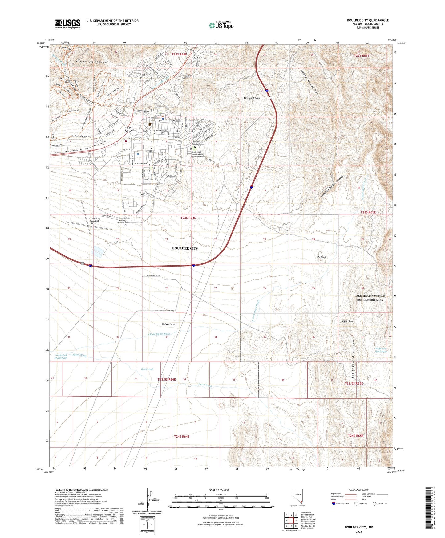
2021 topographic map quadrangle Boulder City in the state of Nevada. Scale: 1:24000. Based on the newly updated USGS 7.5' US Topo map series, this map is in the following counties: Clark. The map contains contour data, water features, and other items you are used to seeing on USGS maps, but also has updated roads and other features. This is the next generation of topographic maps. Printed on high-quality waterproof paper with UV fade-resistant inks.
Quads adjacent to this one:
West: Boulder City NW
Northwest: Henderson
North: Boulder Beach
Northeast: Hoover Dam
East: Ringbolt Rapids
Southeast: Willow Beach
South: Boulder City SE
Southwest: Boulder City SW
This map covers the same area as the classic USGS quad with code o35114h7.
Contains the following named places: Andrew J Mitchell Elementary School, Bootleg Canyon, Bootleg Wash, Boulder City, Boulder City City Hall, Boulder City Fire Department, Boulder City High School, Boulder City Hospital, Boulder City Municipal Airport, Boulder City Police Department, Boulder City Post Office, Camp Knob, Camp Siebert, Christian Center Schools, Community College of Southern Nevada Boulder City Center, Elton M Garrett Junior High School, Grace Christian Academy, Hemenway Pass, KRRI-FM (Boulder City), Lake Mead Christian Academy, Martha P King Elementary School, McKeeversville, Mead Substation Heliport, Mercy Air Services 11, Mountainview Care Center at Boulder City, Nelson Township, Nevada State Veterans Home, North Fork Boy Scout Canyon, North Fork Quail Wash, South Fork Boy Scout Canyon, South Fork Quail Wash, Southern Nevada Veterans Memorial Cemetery, The Knoll, ZIP Code: 89005