MyTopo
Brown Knoll Nevada US Topo Map
Couldn't load pickup availability
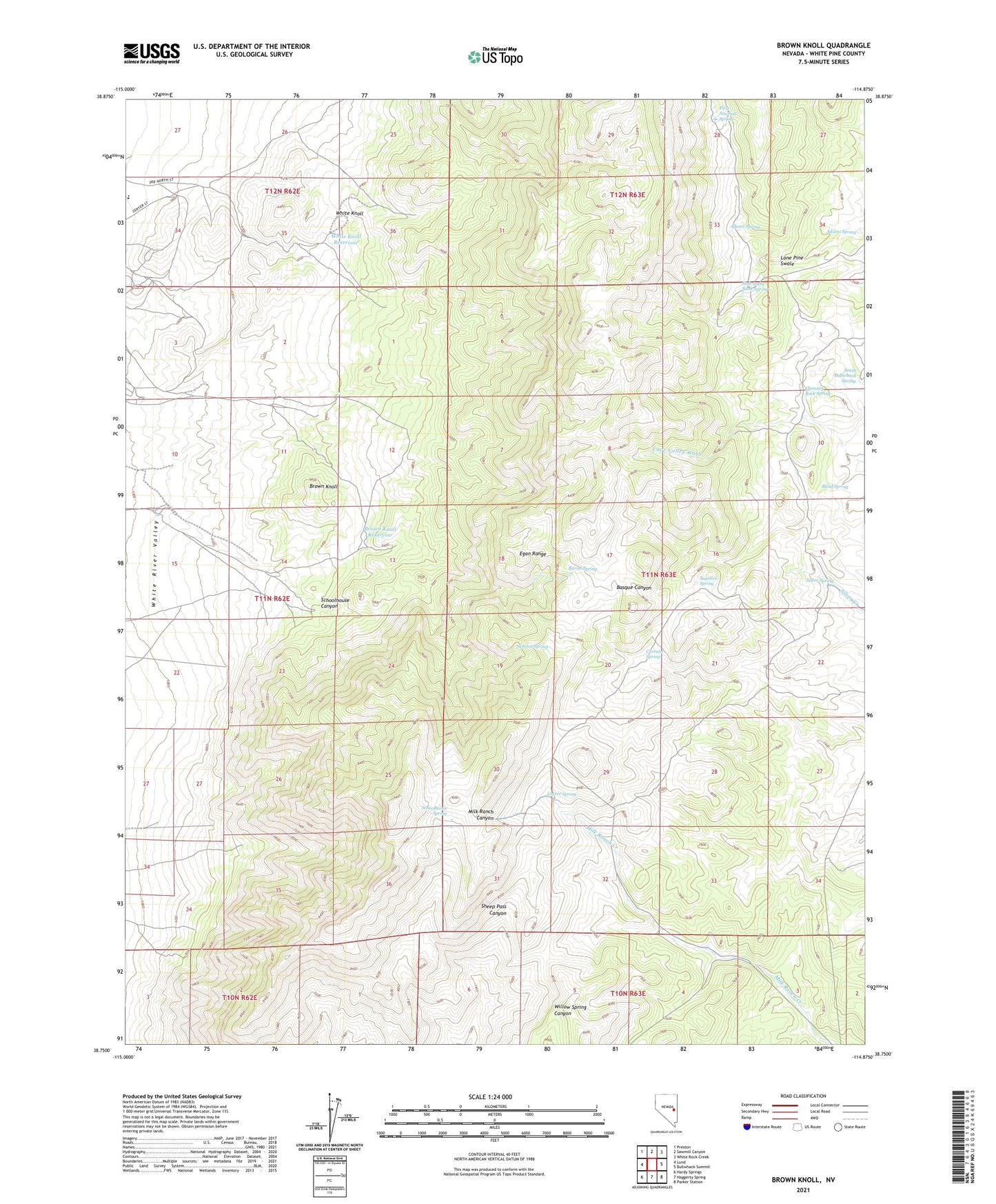
2021 topographic map quadrangle Brown Knoll in the state of Nevada. Scale: 1:24000. Based on the newly updated USGS 7.5' US Topo map series, this map is in the following counties: White Pine. The map contains contour data, water features, and other items you are used to seeing on USGS maps, but also has updated roads and other features. This is the next generation of topographic maps. Printed on high-quality waterproof paper with UV fade-resistant inks.
Quads adjacent to this one:
West: Lund
Northwest: Preston
North: Sawmill Canyon
Northeast: White Rock Creek
East: Bullwhack Summit
Southeast: Parker Station
South: Haggerty Spring
Southwest: Hardy Springs
Contains the following named places: Ab Well, Adams Spring, Albert Well, Barrel Spring, Blind Spring, Brown Knoll, Brown Knoll Reservoir, Carter Spring, Chimney Rock Spring, Currant Spring, First Sawmill Spring, Hole in the Bank Spring, Milk Ranch Corral, Sagehen Spring, Schoolhouse Canyon, Schoolhouse Spring, Silver Spring, South Bullwhack Spring, Summit Spring, White Knoll, White Knoll Reservoir