MyTopo
Sawmill Canyon Nevada US Topo Map
Couldn't load pickup availability
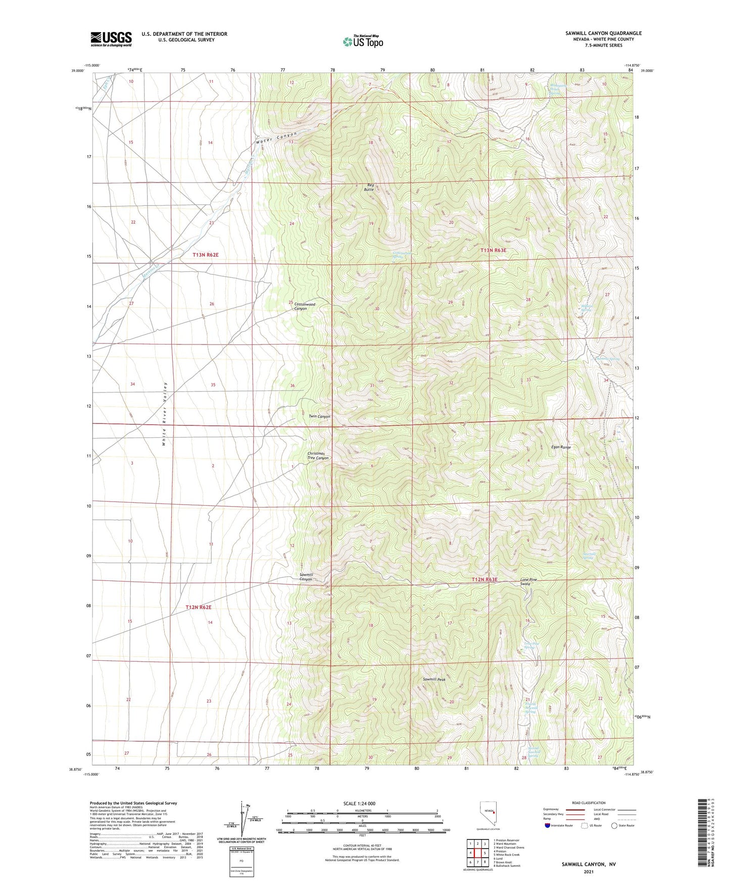
2021 topographic map quadrangle Sawmill Canyon in the state of Nevada. Scale: 1:24000. Based on the newly updated USGS 7.5' US Topo map series, this map is in the following counties: White Pine. The map contains contour data, water features, and other items you are used to seeing on USGS maps, but also has updated roads and other features. This is the next generation of topographic maps. Printed on high-quality waterproof paper with UV fade-resistant inks.
Quads adjacent to this one:
West: Preston
Northwest: Preston Reservoir
North: Ward Mountain
Northeast: Ward Charcoal Ovens
East: White Rock Creek
Southeast: Bullwhack Summit
South: Brown Knoll
Southwest: Lund
This map covers the same area as the classic USGS quad with code o38114h8.
Contains the following named places: Christmas Tree Canyon, Cottonwood Canyon, Cottonwood Spring, Ellison Mine, Ellison Mining District, Fourth Sawmill Spring, Hendrix Mine, Johnson Boys Mine, Lone Pine Spring, Lone Pine Swale, Mahogany Hotel Spring, Millard Spring, Red Butte, Sawmill Canyon, Sawmill Peak, Sawmill Spring, Second Sawmill Spring, Summit Spring, Twin Canyon, Water Canyon, Water Canyon Holding Corral