MyTopo
Bullwhack Summit Nevada US Topo Map
Couldn't load pickup availability
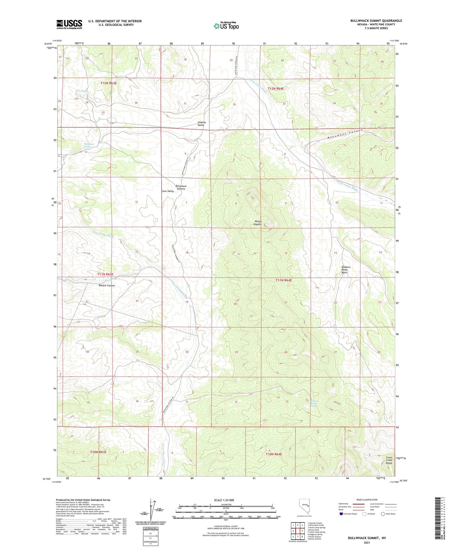
2021 topographic map quadrangle Bullwhack Summit in the state of Nevada. Scale: 1:24000. Based on the newly updated USGS 7.5' US Topo map series, this map is in the following counties: White Pine. The map contains contour data, water features, and other items you are used to seeing on USGS maps, but also has updated roads and other features. This is the next generation of topographic maps. Printed on high-quality waterproof paper with UV fade-resistant inks.
Quads adjacent to this one:
West: Brown Knoll
Northwest: Sawmill Canyon
North: White Rock Creek
Northeast: Horse Camp Springs
East: Cattle Camp Spring
Southeast: Mount Grafton
South: Parker Station
Southwest: Haggerty Spring
This map covers the same area as the classic USGS quad with code o38114g7.
Contains the following named places: Basque Canyon, Bullwhack Spring, Bullwhack Summit, Cave Valley Corral, Jones Spring, Lund Group Well, Mollys Nipples, Monument Canyon, Robbers Roost Basin, Robbers Roost Spring, Robbers Roost Well, Silver Creek, Steptoe Valley