MyTopo
Browns Bench Ranch Nevada US Topo Map
Couldn't load pickup availability
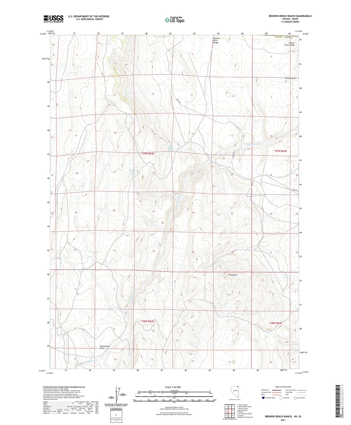
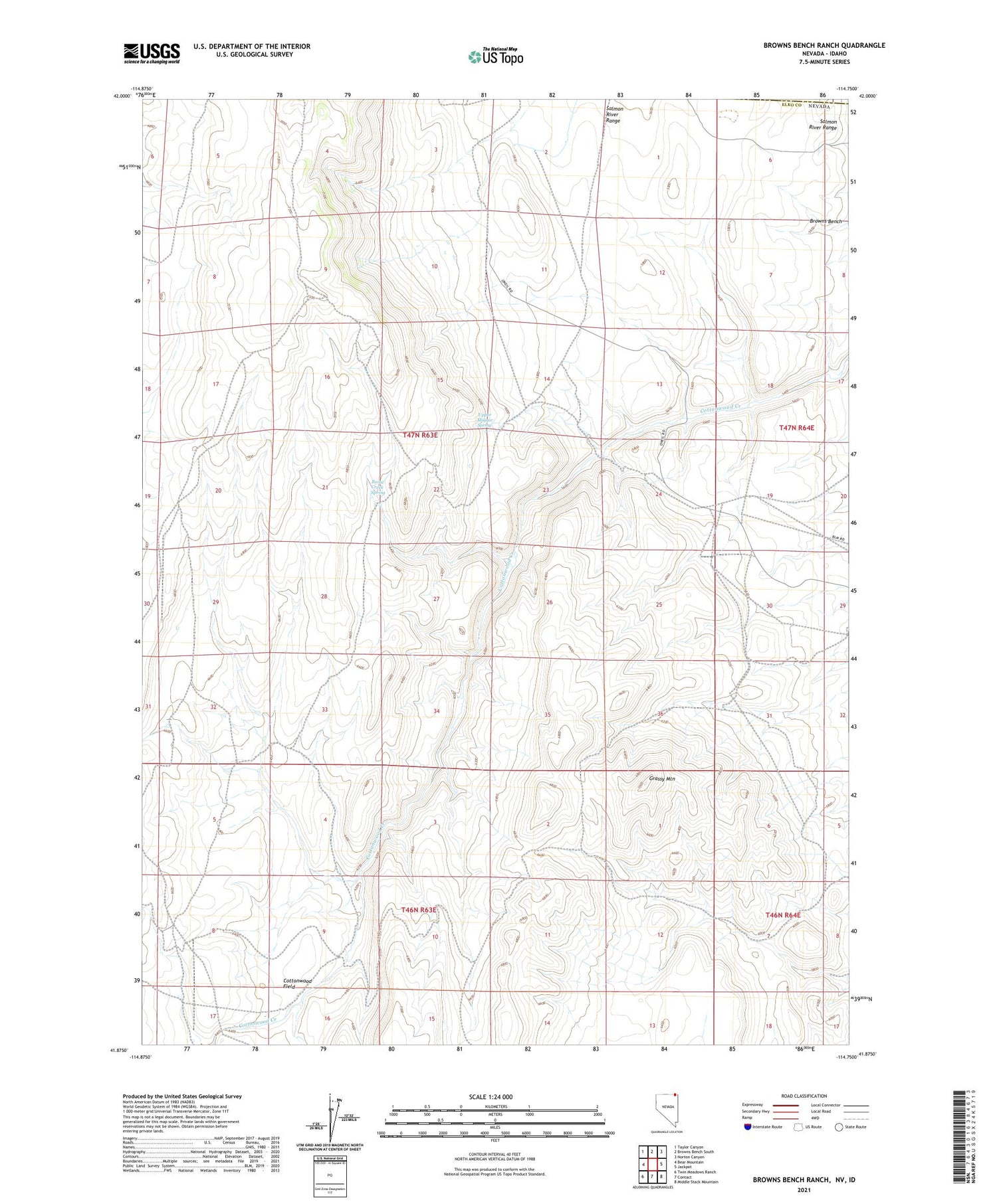
2021 topographic map quadrangle Browns Bench Ranch in the state of Nevada. Scale: 1:24000. Based on the newly updated USGS 7.5' US Topo map series, this map is in the following counties: Elko, Twin Falls. The map contains contour data, water features, and other items you are used to seeing on USGS maps, but also has updated roads and other features. This is the next generation of topographic maps. Printed on high-quality waterproof paper with UV fade-resistant inks.
Quads adjacent to this one:
West: Bear Mountain
Northwest: Taylor Canyon
North: Browns Bench South
Northeast: Norton Canyon
East: Jackpot
Southeast: Middle Stack Mountain
South: Contact
Southwest: Twin Meadows Ranch
Contains the following named places: Browns Bench, Browns Bench Ranch, Burnt Creek Spring, Grassy Mountain, Upper Maggie Spring, ZIP Code: 89825