MyTopo
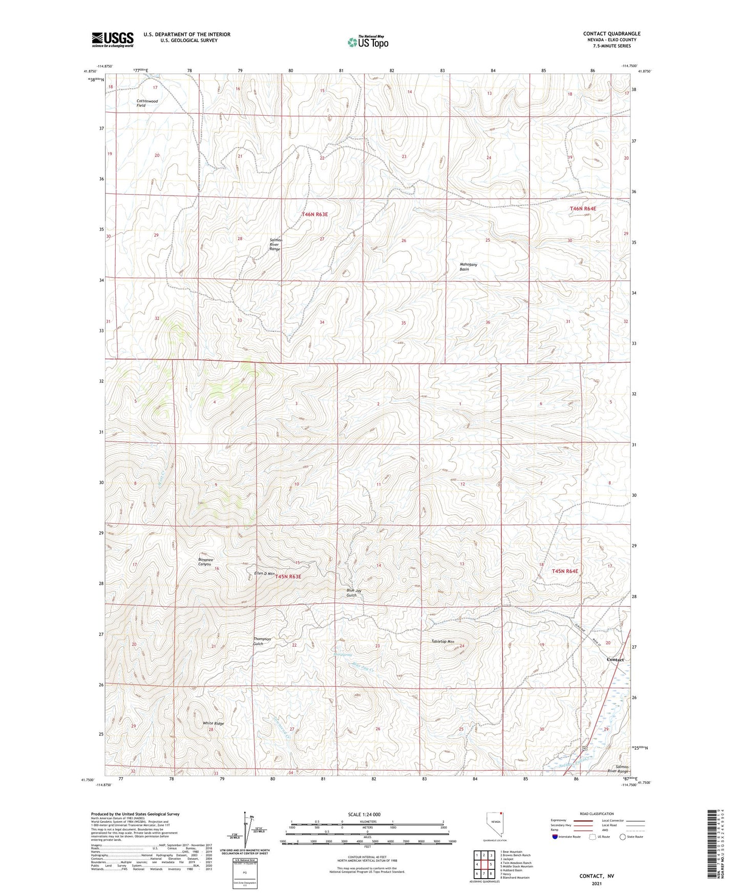
Contact Nevada US Topo Map
Couldn't load pickup availability
2021 topographic map quadrangle Contact in the state of Nevada. Scale: 1:24000. Based on the newly updated USGS 7.5' US Topo map series, this map is in the following counties: Elko. The map contains contour data, water features, and other items you are used to seeing on USGS maps, but also has updated roads and other features. This is the next generation of topographic maps. Printed on high-quality waterproof paper with UV fade-resistant inks.
Quads adjacent to this one:
West: Twin Meadows Ranch
Northwest: Bear Mountain
North: Browns Bench Ranch
Northeast: Jackpot
East: Middle Stack Mountain
Southeast: Blanchard Mountain
South: Henry
Southwest: Hubbard Basin
This map covers the same area as the classic USGS quad with code o41114g7.
Contains the following named places: Antelope Mine, Bear Spring, Bellevue Mine, Blue Bird Mine, Bonanza Mine, Brooklyn Mine, Contact, Contact Post Office, Contact School, Copper King Mine, Copper Shield Mine, Cottonwood Field, Delano Mine, Ellen D Mountain, Jackpot Township, Mahogany Basin, Mammoth Mine, Marshall Mine, Nevada Bellevue Mine, Palo Alto Mine, Salmon River Range, Silver Circle Mine, Tabletop Mountain