MyTopo
Buffalo Mountain Nevada US Topo Map
Couldn't load pickup availability
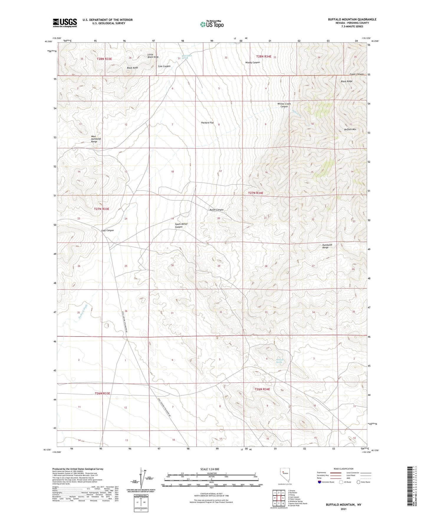
2021 topographic map quadrangle Buffalo Mountain in the state of Nevada. Scale: 1:24000. Based on the newly updated USGS 7.5' US Topo map series, this map is in the following counties: Pershing. The map contains contour data, water features, and other items you are used to seeing on USGS maps, but also has updated roads and other features. This is the next generation of topographic maps. Printed on high-quality waterproof paper with UV fade-resistant inks.
Quads adjacent to this one:
West: Coal Canyon
Northwest: Oreana
North: Rochester
Northeast: Fitting
East: Fisher Canyon
Southeast: Cornish Peak
South: Buena Vista Hills North
Southwest: Wildhorse Spring
Contains the following named places: Antelope Spring, Antelope Springs Mining District, Batavia and Pacific Mill, Black Knob, Black Knob Mining District, Black Knob Spring, Black Ridge, Bohannon Mine, Buffalo Mountain, Cervantite Mine, Coal Canyon, Cole Canyon, Eastern Star Mine, Foltz, Foltz Post Office, Good Spot Mine, Little Black Knob, Lori Mine, Montgomery Mine, Nevada Almaden Mines, Nevada Quicksilver Mine, Packard Flat, Pershing Mine, Pershing Quicksilver Mine, Red Bird Mine, Relief, Relief Canyon, Relief Mine, Relief Well, South Relief Canyon, Vulture Mine, Willow Creek, Willow Creek Canyon, Woody Canyon