MyTopo
Buena Vista Hills North Nevada US Topo Map
Couldn't load pickup availability
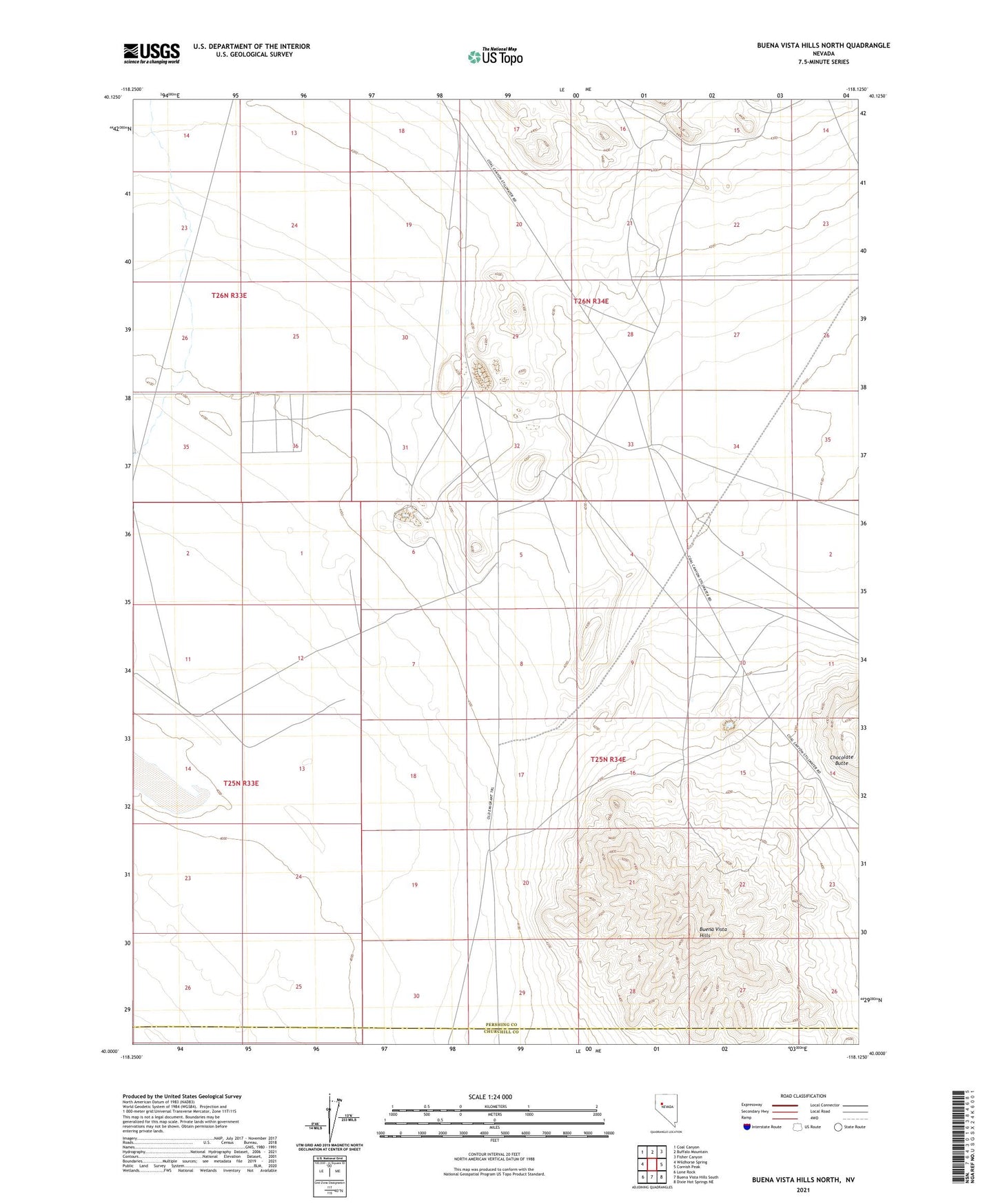
2021 topographic map quadrangle Buena Vista Hills North in the state of Nevada. Scale: 1:24000. Based on the newly updated USGS 7.5' US Topo map series, this map is in the following counties: Pershing, Churchill. The map contains contour data, water features, and other items you are used to seeing on USGS maps, but also has updated roads and other features. This is the next generation of topographic maps. Printed on high-quality waterproof paper with UV fade-resistant inks.
Quads adjacent to this one:
West: Wildhorse Spring
Northwest: Coal Canyon
North: Buffalo Mountain
Northeast: Fisher Canyon
East: Cornish Peak
Southeast: Dixie Hot Springs NE
South: Buena Vista Hills South
Southwest: Lone Rock
This map covers the same area as the classic USGS quad with code o40118a2.
Contains the following named places: American Ore Section Sixteen Mine, American Ore Section Ten Mine, American Ore Section Thirtytwo Mine, Beacon Hill Mine, Buena Vista Hills, Ford Mine, Hermatite Mine, Iron Castle Mine, Mineral Basin Mining District, Nevada Iron Ore Mine, Rockwell Station, Section Thirty-one Mine, Segerstrom-Heizer Mine, Southeast Section Twentynine Mine, Thomas Mine