MyTopo
Coal Canyon Nevada US Topo Map
Couldn't load pickup availability
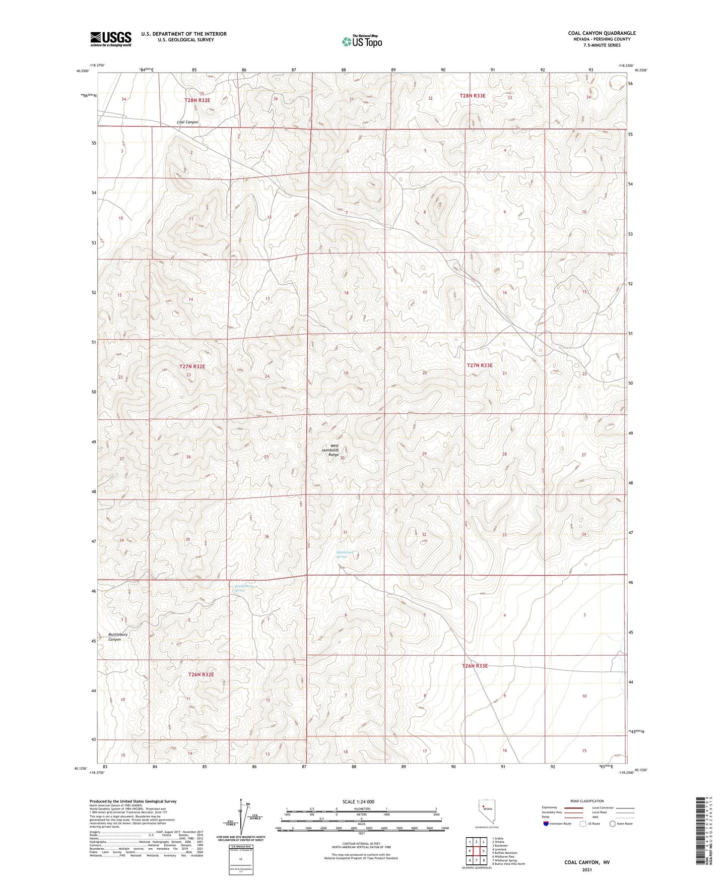
2021 topographic map quadrangle Coal Canyon in the state of Nevada. Scale: 1:24000. Based on the newly updated USGS 7.5' US Topo map series, this map is in the following counties: Pershing. The map contains contour data, water features, and other items you are used to seeing on USGS maps, but also has updated roads and other features. This is the next generation of topographic maps. Printed on high-quality waterproof paper with UV fade-resistant inks.
Quads adjacent to this one:
West: Lovelock
Northwest: Arabia
North: Oreana
Northeast: Rochester
East: Buffalo Mountain
Southeast: Buena Vista Hills North
South: Wildhorse Spring
Southwest: Wildhorse Pass
This map covers the same area as the classic USGS quad with code o40118b3.
Contains the following named places: Coal Canyon, Loring, Muckleberry Spring, Muttlebury Canyon, Muttlebury Mine, Muttlebury Mining District, Muttlebury Spring, Muttlebury Well, Section Eleven Clay mine, Section Six Clay Mine, Sheepherder Mine, Sutherland Mine, Treasure Hill Mine, Willard Mining District