MyTopo
Calcutta Lake Nevada US Topo Map
Couldn't load pickup availability
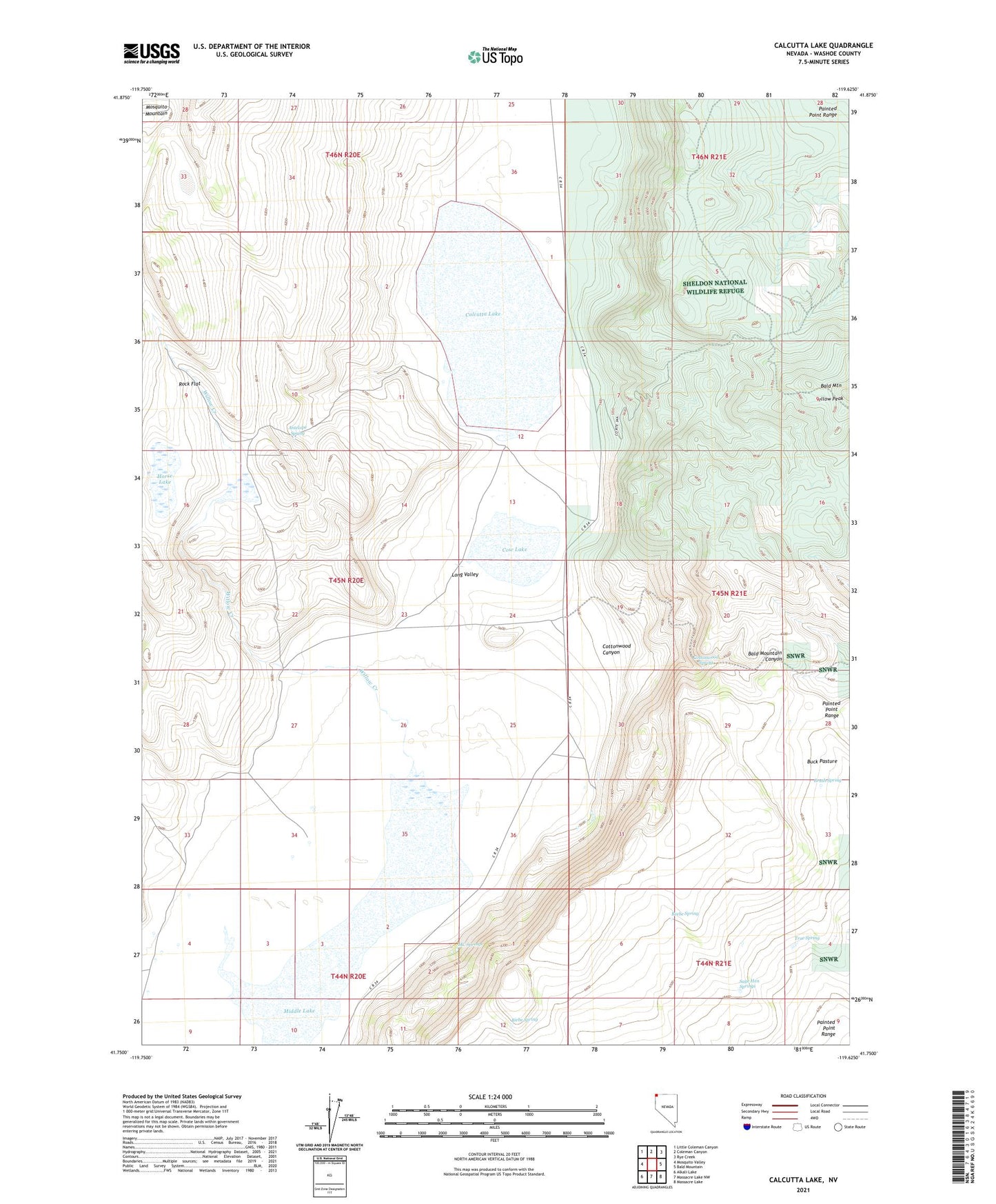
2021 topographic map quadrangle Calcutta Lake in the state of Nevada. Scale: 1:24000. Based on the newly updated USGS 7.5' US Topo map series, this map is in the following counties: Washoe. The map contains contour data, water features, and other items you are used to seeing on USGS maps, but also has updated roads and other features. This is the next generation of topographic maps. Printed on high-quality waterproof paper with UV fade-resistant inks.
Quads adjacent to this one:
West: Mosquito Valley
Northwest: Little Coleman Canyon
North: Coleman Canyon
Northeast: Rye Creek
East: Bald Mountain
Southeast: Massacre Lake
South: Massacre Lake NW
Southwest: Alkali Lake
This map covers the same area as the classic USGS quad with code o41119g6.
Contains the following named places: Antelope Spring, Beebe Spring, Biebe Spring, Board Corral Ranch, Brush Spring, Buck Pasture, Calcutta Lake, Calcutta Ranch, Coffey Reservoir, Cottonwood Canyon, Cottonwood Spring, Cow Lake, Cow Lake Well, Horse Lake, MC Springs, Middle Lake, Painted Point Range, Rock Flat, Sage Hen Springs, True Spring, Willow Creek, Wimer Place