MyTopo
Cherry Creek SE Nevada US Topo Map
Couldn't load pickup availability
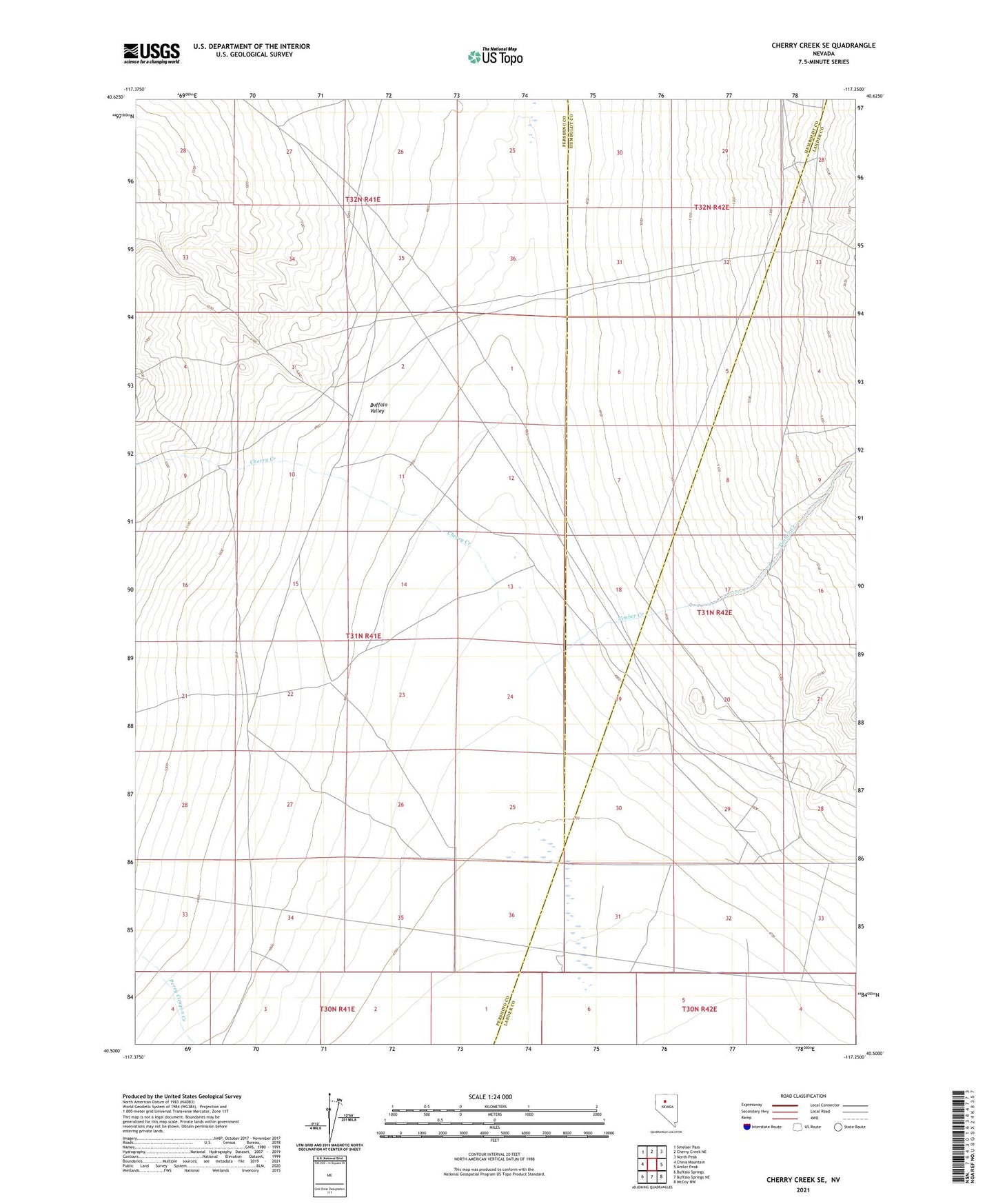
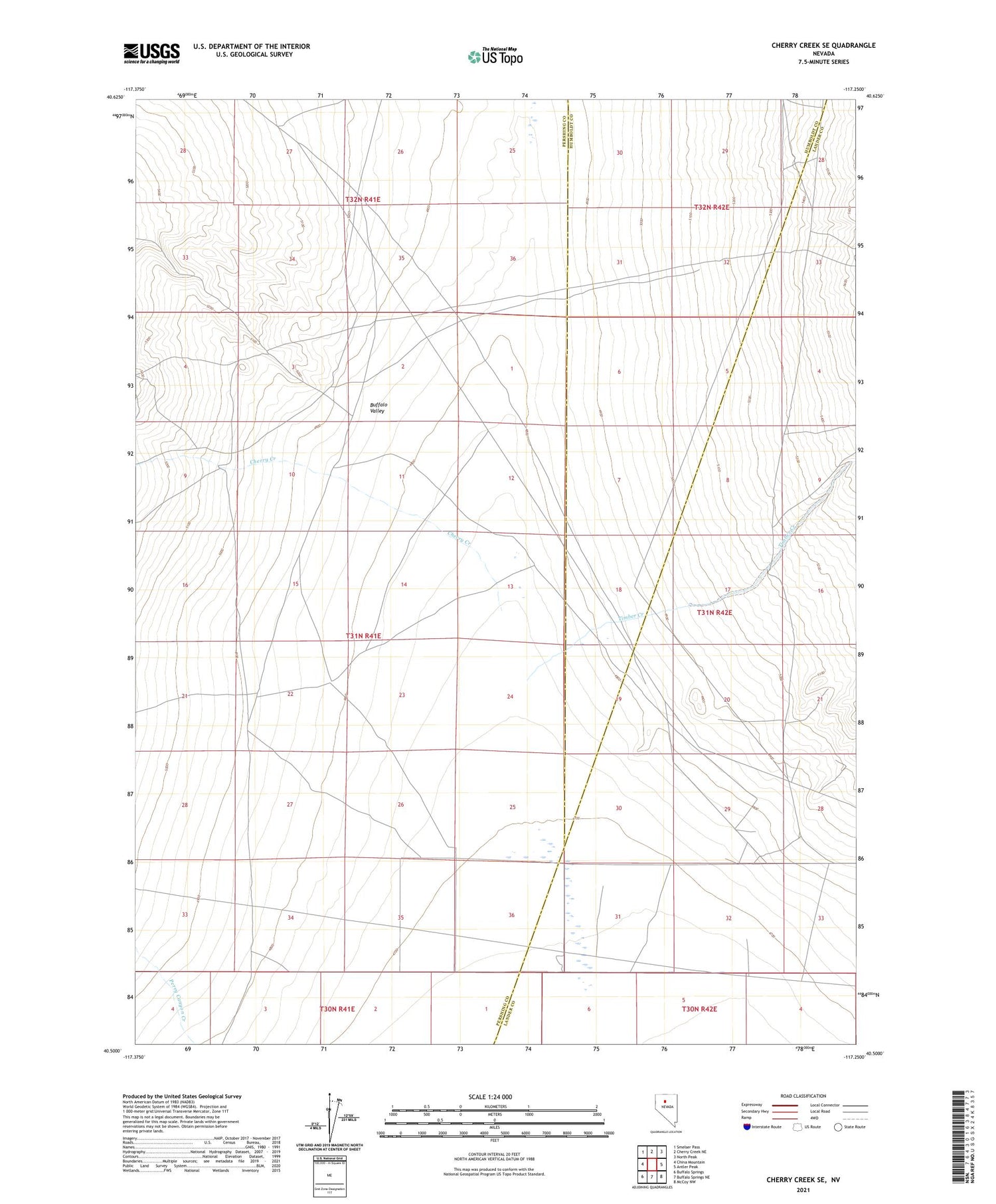
2021 topographic map quadrangle Cherry Creek SE in the state of Nevada. Scale: 1:24000. Based on the newly updated USGS 7.5' US Topo map series, this map is in the following counties: Pershing, Lander, Humboldt. The map contains contour data, water features, and other items you are used to seeing on USGS maps, but also has updated roads and other features. This is the next generation of topographic maps. Printed on high-quality waterproof paper with UV fade-resistant inks.
Quads adjacent to this one:
West: China Mountain
Northwest: Smelser Pass
North: Cherry Creek NE
Northeast: North Peak
East: Antler Peak
Southeast: McCoy NW
South: Buffalo Springs NE
Southwest: Buffalo Springs
Contains the following named places: Buffalo Valley, Cherry Creek, Honeycomb Mine, Timber Creek