MyTopo
Chuck Wagon Flat Nevada US Topo Map
Couldn't load pickup availability
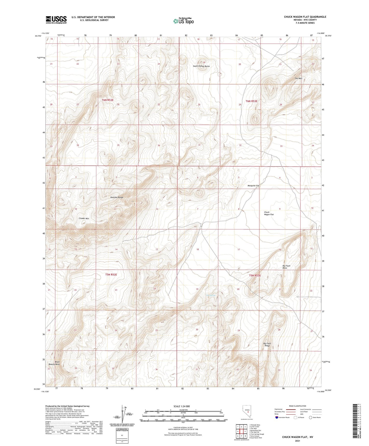
2021 topographic map quadrangle Chuck Wagon Flat in the state of Nevada. Scale: 1:24000. Based on the newly updated USGS 7.5' US Topo map series, this map is in the following counties: Nye. The map contains contour data, water features, and other items you are used to seeing on USGS maps, but also has updated roads and other features. This is the next generation of topographic maps. Printed on high-quality waterproof paper with UV fade-resistant inks.
Quads adjacent to this one:
West: Buckwheat Rim
Northwest: Palisade Mesa
North: Lunar Crater
Northeast: The Wall
East: The Wall SW
Southeast: Goat Ranch Well
South: Echo Canyon
Southwest: Twin Springs Slough
This map covers the same area as the classic USGS quad with code o38116c1.
Contains the following named places: Badland Reservoir Number Two, Big Fault Mesa, Big Fault Ridge, Black Beauty Mesa, Chuck Wagon Flat, Citadel Mountain, Mesquite Flat, South Kidney Butte, Surveyors Well, Tule Spring