MyTopo
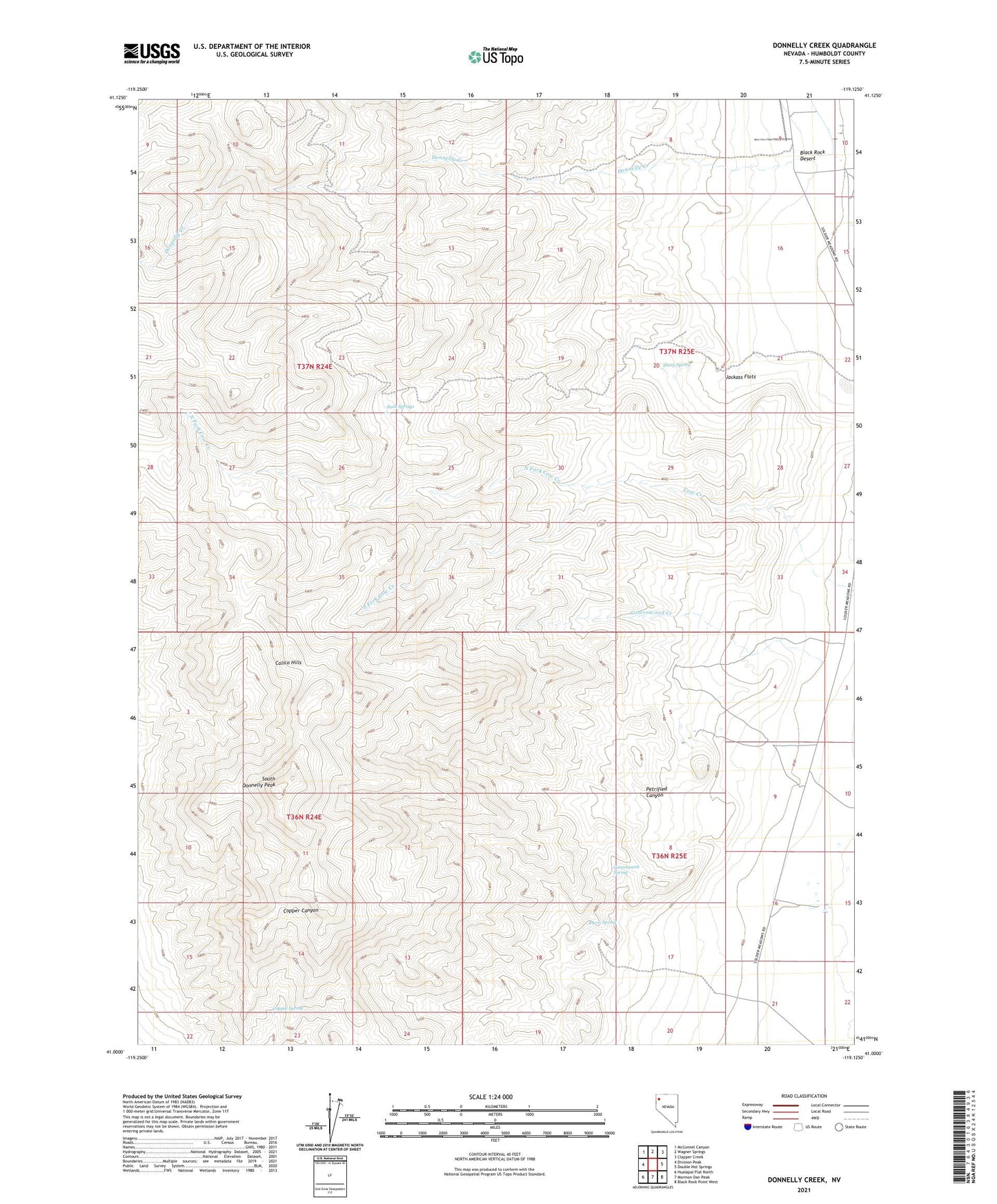
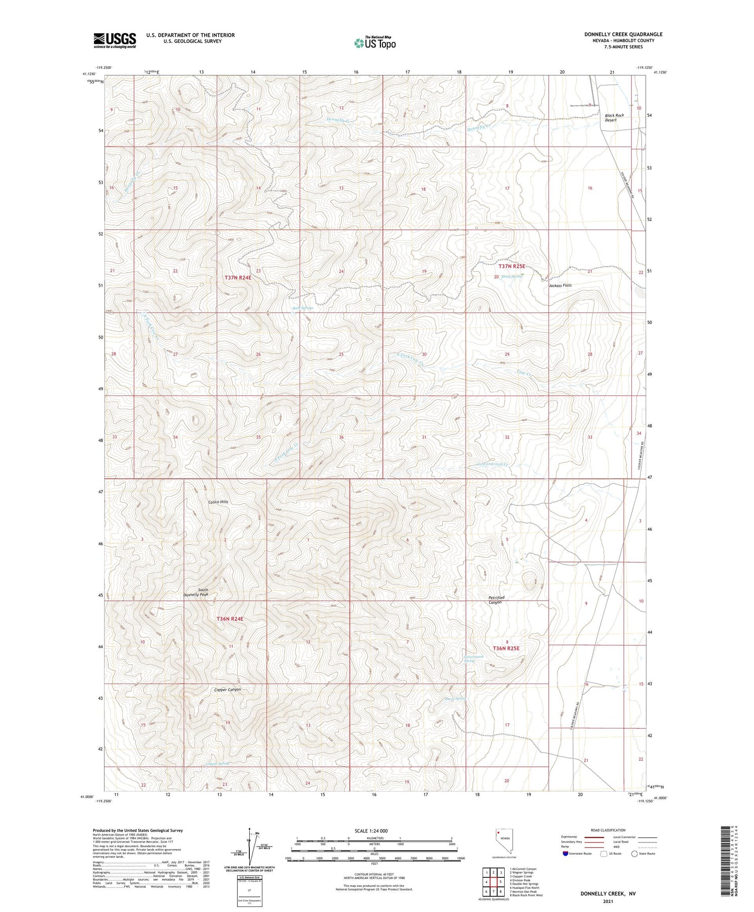
Donnelly Creek Nevada US Topo Map
Couldn't load pickup availability
2021 topographic map quadrangle Donnelly Creek in the state of Nevada. Scale: 1:24000. Based on the newly updated USGS 7.5' US Topo map series, this map is in the following counties: Humboldt. The map contains contour data, water features, and other items you are used to seeing on USGS maps, but also has updated roads and other features. This is the next generation of topographic maps. Printed on high-quality waterproof paper with UV fade-resistant inks.
Quads adjacent to this one:
West: Division Peak
Northwest: McConnel Canyon
North: Wagner Springs
Northeast: Clapper Creek
East: Double Hot Springs
Southeast: Black Rock Point West
South: Mormon Dan Peak
Southwest: Hualapai Flat North
Contains the following named places: Buck Springs, Burro Spring, Calico Mountains Wilderness, Copper Spring, Cottonwood Creek, Finley Ranch, Government Spring, Jackass Flats, Jackson Ranch, Morley Place, North Fork Cow Creek, Petrified Canyon, Sheep Spring, Soldier Meadow Number 2 Airport, South Donnelly Peak, South Fork Cow Creek, States Ranch