MyTopo
Hualapai Flat North Nevada US Topo Map
Couldn't load pickup availability
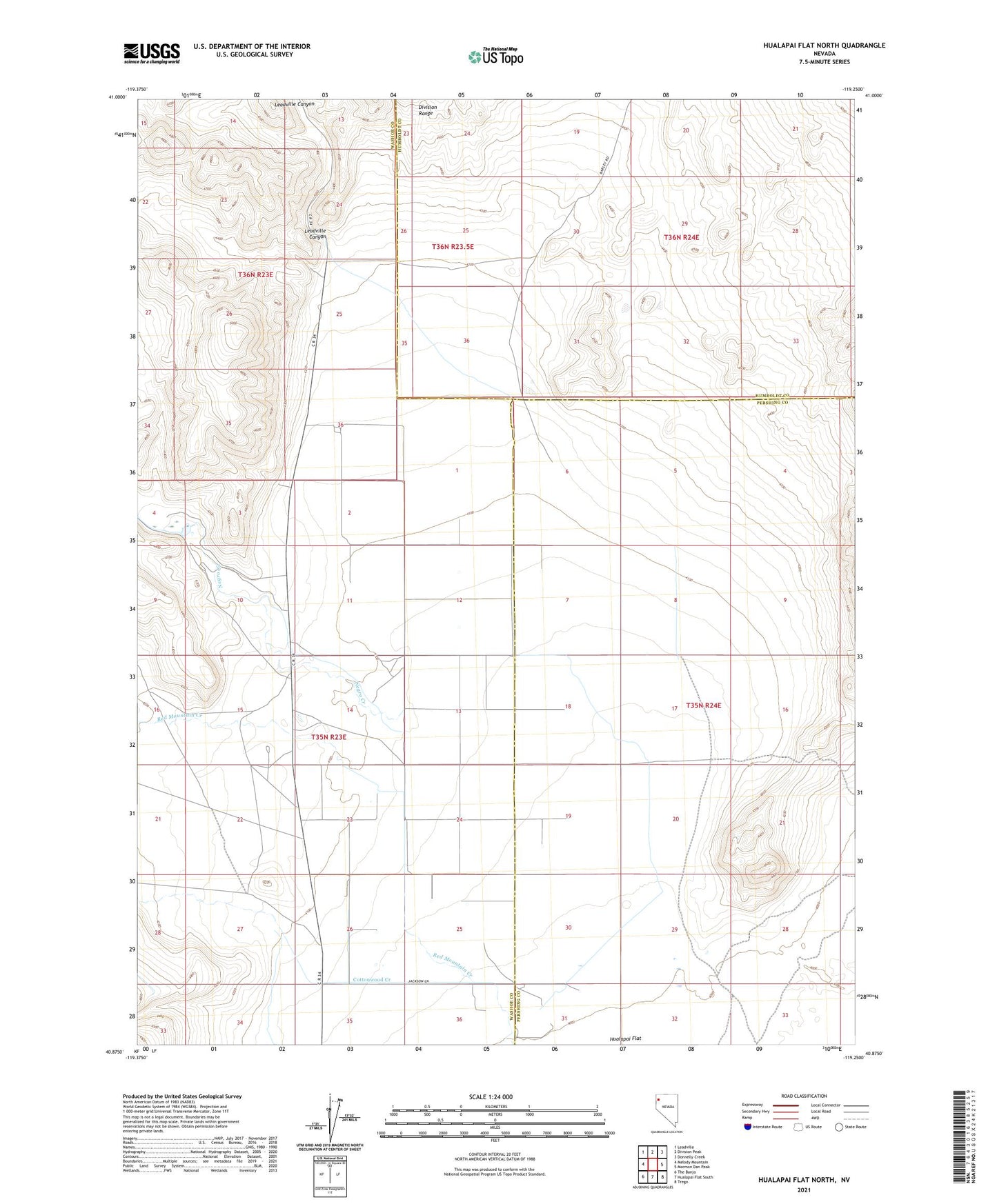
2021 topographic map quadrangle Hualapai Flat North in the state of Nevada. Scale: 1:24000. Based on the newly updated USGS 7.5' US Topo map series, this map is in the following counties: Washoe, Pershing, Humboldt. The map contains contour data, water features, and other items you are used to seeing on USGS maps, but also has updated roads and other features. This is the next generation of topographic maps. Printed on high-quality waterproof paper with UV fade-resistant inks.
Quads adjacent to this one:
West: Melody Mountain
Northwest: Leadville
North: Division Peak
Northeast: Donnelly Creek
East: Mormon Dan Peak
Southeast: Trego
South: Hualapai Flat South
Southwest: The Banjo
This map covers the same area as the classic USGS quad with code o40119h3.
Contains the following named places: Bailey Well, Crossley 99 Ranch, Hualipi, Hualipi Post Office, Iveson Ranch, Leadville Canyon, Negro Creek