MyTopo
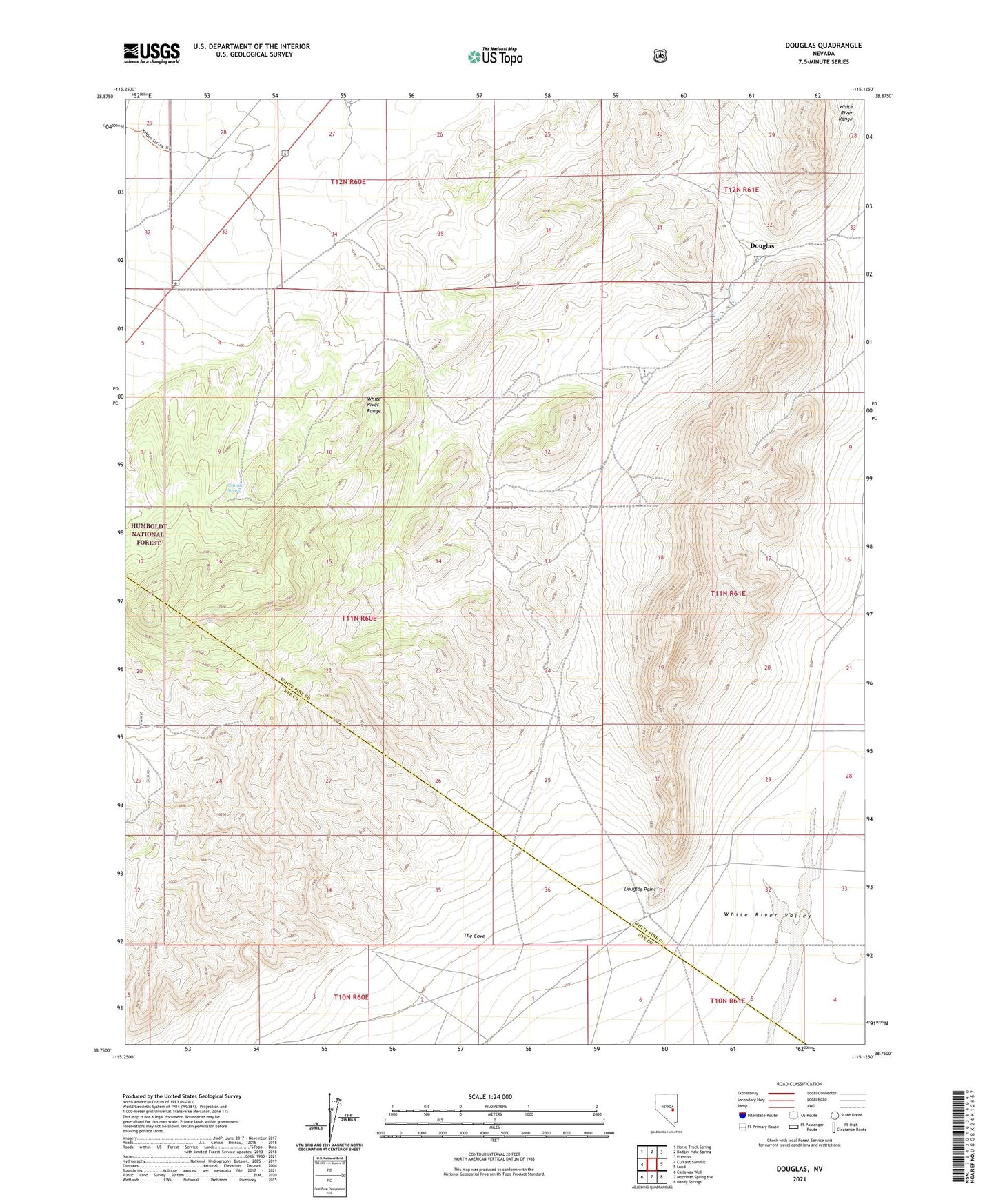
Douglas Nevada US Topo Map
Couldn't load pickup availability
Also explore the Douglas Forest Service Topo of this same quad for updated USFS data
2021 topographic map quadrangle Douglas in the state of Nevada. Scale: 1:24000. Based on the newly updated USGS 7.5' US Topo map series, this map is in the following counties: White Pine, Nye. The map contains contour data, water features, and other items you are used to seeing on USGS maps, but also has updated roads and other features. This is the next generation of topographic maps. Printed on high-quality waterproof paper with UV fade-resistant inks.
Quads adjacent to this one:
West: Currant Summit
Northwest: Horse Track Spring
North: Badger Hole Spring
Northeast: Preston
East: Lund
Southeast: Hardy Springs
South: Moorman Spring NW
Southwest: Callaway Well
This map covers the same area as the classic USGS quad with code o38115g2.
Contains the following named places: Douglas, Douglas Point, Douglas Point Well, Granite Spring, White River Range